IMAGES TAKEN NEAR TO
Aden Grove, LONDON, N16 9NL

Introduction

This page details the photographs taken nearby to Aden Grove, N16 9NL by members of the Geograph project.

The Geograph project started in 2005 with the aim of publishing, organising and preserving representative images for every square kilometre of Great Britain, Ireland and the Isle of Man.

There are currently over 7.5m images from over14,400 individuals and you can help contribute to the project by visiting https://www.geograph.org.uk

Image Map


Images are licensed for reuse under creativecommons.org/licenses/by-sa/2.0
Notes
  • Clicking on the map will re-center to the selected point.
  • The higher the marker number, the further away the image location is from the centre of the postcode.

Image Listing (156 Images Found)

Images are licensed for reuse under creativecommons.org/licenses/by-sa/2.0
  • ...
Image
Details
Distance
1
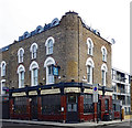
The Monarch, Stoke Newington
Image: © Chris Whippet Taken: 1 Jan 2014
0.05 miles
2
The Monarch, Stoke Newington
Comparison shot from January 2014: http://www.geograph.org.uk/photo/3803591
Image: © Chris Whippet Taken: 12 Jul 2015
0.05 miles
3
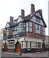
The Leconfield, Stoke Newington
Image: © Chris Whippet Taken: 1 Jan 2014
0.06 miles
4
Lidfield Road, Stoke Newington
Image: © Chris Whippet Taken: 12 Jul 2015
0.06 miles
5
"Winnicott" public house and bar, Green Lanes
Built as "The Monarch" public house, a Charringtons house.
Image: © Jim Osley Taken: 6 May 2017
0.06 miles
6
Newington Green: Green Lanes
This road is part of the A105
Image: © Dr Neil Clifton Taken: 7 Oct 2010
0.07 miles
7
Winston Road, Stoke Newington
Image: © Chris Whippet Taken: 12 Jul 2015
0.08 miles
8
Green Lanes N16, looking South
This was taken at the junction of Springdale Road. It is a mile or so away from the two major centres of the Turkish Community (Stoke Newington and Harringay) but from the shops here it is obvious there is a sizeable proportion of Turkish people living near here.
Image: © Danny P Robinson Taken: 14 May 2006
0.09 miles
9
Lidfield Road N16
Taken at the junction of Green Lanes. Note the skip, after the 3rd car on the left. This suggests a house is being renovated and an area in the process of gentrification.
Image: © Danny P Robinson Taken: 14 May 2006
0.09 miles
10
"The Leconfield" public house, Green Lanes
Built as the "Royal Oak Refreshment House".
Image: © Jim Osley Taken: 6 May 2017
0.09 miles
  • ...