IMAGES TAKEN NEAR TO
Lemsford Close, LONDON, N15 6BF
Introduction
This page details the photographs taken nearby to Lemsford Close, N15 6BF by members of the Geograph project.
The Geograph project started in 2005 with the aim of publishing, organising and preserving representative images for every square kilometre of Great Britain, Ireland and the Isle of Man.

There are currently over 7.5m images from over14,400 individuals and you can help contribute to the project by visiting https://www.geograph.org.uk
Image Map
Images are licensed for reuse under creativecommons.org/licenses/by-sa/2.0
Notes
- Clicking on the map will re-center to the selected point.
- The higher the marker number, the further away the image location is from the centre of the postcode.
Image Listing (134 Images Found)
Images are licensed for reuse under creativecommons.org/licenses/by-sa/2.0
Image
Details
Distance
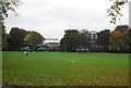
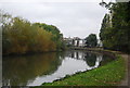
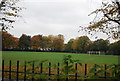
5
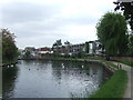
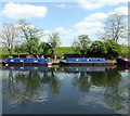
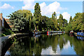
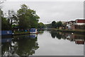
River Lea near Stamford Hill
The towpath along the river bank is shared by walkers and cyclists. It forms par of National Cycle Network route 1.
Image: © Malc McDonald
Taken: 1 Jun 2013
0.06 miles