IMAGES TAKEN NEAR TO
Stonebridge Road, LONDON, N15 5PF
Introduction
This page details the photographs taken nearby to Stonebridge Road, N15 5PF by members of the Geograph project.
The Geograph project started in 2005 with the aim of publishing, organising and preserving representative images for every square kilometre of Great Britain, Ireland and the Isle of Man.

There are currently over 7.5m images from over14,400 individuals and you can help contribute to the project by visiting https://www.geograph.org.uk
Image Map
Images are licensed for reuse under creativecommons.org/licenses/by-sa/2.0
Notes
- Clicking on the map will re-center to the selected point.
- The higher the marker number, the further away the image location is from the centre of the postcode.
Image Listing (204 Images Found)
Images are licensed for reuse under creativecommons.org/licenses/by-sa/2.0
Image
Details
Distance
3
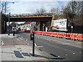
Seven Sisters Road, Seven Sisters
Seven Sisters Road forms part of the route of the A503 as it passes through north London. New apartment blocks are nearing completion on the other side of the road.
Image: © Malc McDonald
Taken: 1 Feb 2020
0.04 miles
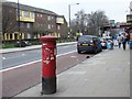
4
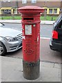
Edward VII postbox, Seven Sisters Road, N15
Image: © Mike Quinn
Taken: 8 Feb 2017
0.04 miles
5
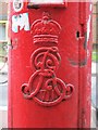
Edward VII postbox, Seven Sisters Road, N15 - royal cipher
See Image
Image: © Mike Quinn
Taken: 8 Feb 2017
0.04 miles
6
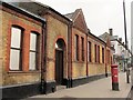
Kingdom Hall of Jehovah's Witnesses, Seven Sisters Road, N15
Shows the location of Image
Image: © Mike Quinn
Taken: 8 Feb 2017
0.04 miles
7
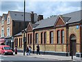
Kingdom Hall of Jehovah's Witnesses, Seven Sisters Road, N15
Shows the location of Image
Image: © Mike Quinn
Taken: 7 Jun 2017
0.04 miles
8
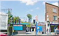
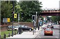
Entrance to Seven Sisters Station
View NW on Seven Sisters Road: ex-GER suburban lines from Liverpool Street to Lower Edmonton, Enfield Town and Cheshunt via Churchbury, also London Underground Victoria Line since 1968.
Image: © Ben Brooksbank
Taken: 3 Aug 2007
0.04 miles
9
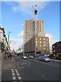
Seven Sisters Road, N15
Shows the location of Image (left).
Image: © Mike Quinn
Taken: 18 Jun 2015
0.04 miles
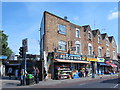
10
Seven Sisters Road, N15
The south side, east of Stonebridge Road. Shows the location of Image
Image: © Mike Quinn
Taken: 8 Feb 2017
0.04 miles