IMAGES TAKEN NEAR TO
Seven Sisters Road, LONDON, N15 5LE
Introduction
This page details the photographs taken nearby to Seven Sisters Road, N15 5LE by members of the Geograph project.
The Geograph project started in 2005 with the aim of publishing, organising and preserving representative images for every square kilometre of Great Britain, Ireland and the Isle of Man.

There are currently over 7.5m images from over14,400 individuals and you can help contribute to the project by visiting https://www.geograph.org.uk
Image Map
Images are licensed for reuse under creativecommons.org/licenses/by-sa/2.0
Notes
- Clicking on the map will re-center to the selected point.
- The higher the marker number, the further away the image location is from the centre of the postcode.
Image Listing (191 Images Found)
Images are licensed for reuse under creativecommons.org/licenses/by-sa/2.0
Image
Details
Distance
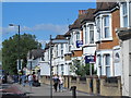
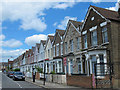
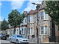
2
Seven Sisters Road, N15 (2)
The north side, between Greenfield Road and Elizabeth Road.
Image: © Mike Quinn
Taken: 7 Jun 2017
0.03 miles
5
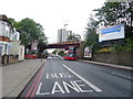
Railway bridge over Seven Sisters Road, South Tottenham
Image: © JThomas
Taken: 20 Jul 2019
0.04 miles
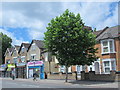
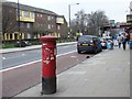
6
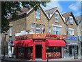
The ARLINGTON Caf?, Seven Sisters Road / Elizabeth Road, N15
Image: © Mike Quinn
Taken: 7 Jun 2017
0.05 miles
9
Faux mediaeval castle, Birstall Road, N15
Image: © Mike Quinn
Taken: 7 Jun 2017
0.05 miles
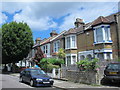
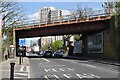
10
Seven Sisters Road, N15
The south side, east of Stonebridge Road. Shows the location of Image
Image: © Mike Quinn
Taken: 8 Feb 2017
0.06 miles