IMAGES TAKEN NEAR TO
Blenheim Rise, Talbot Road, LONDON, N15 4TJ
Introduction
This page details the photographs taken nearby to Blenheim Rise, Talbot Road, N15 4TJ by members of the Geograph project.
The Geograph project started in 2005 with the aim of publishing, organising and preserving representative images for every square kilometre of Great Britain, Ireland and the Isle of Man.

There are currently over 7.5m images from over14,400 individuals and you can help contribute to the project by visiting https://www.geograph.org.uk
Image Map
Images are licensed for reuse under creativecommons.org/licenses/by-sa/2.0
Notes
- Clicking on the map will re-center to the selected point.
- The higher the marker number, the further away the image location is from the centre of the postcode.
Image Listing (226 Images Found)
Images are licensed for reuse under creativecommons.org/licenses/by-sa/2.0
Image
Details
Distance
1
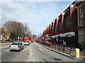
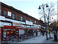
Tottenham High Road, Seven Sisters, London N15
Image: © Stacey Harris
Taken: 22 Mar 2010
0.01 miles
2
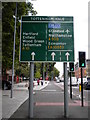
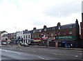
Tottenham Hale street sign, High Road N15
Image: © Robin Sones
Taken: 11 Aug 2011
0.03 miles
3
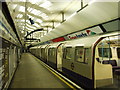
Seven Sisters Underground Station
Slightly incorrect position.
Image: © Chris Whippet
Taken: 4 Jan 2009
0.03 miles
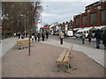
7
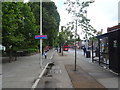
London Cycle Superhighway 1
Beside High Road (A10) - towards Tottenham.
Image: © JThomas
Taken: 20 Jul 2019
0.04 miles
8
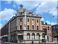
Former Barclays Bank, High Road / Broad Lane, N15
Image: © Mike Quinn
Taken: 7 Jun 2017
0.04 miles
9
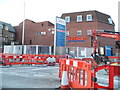
Tesco on Broad Lane, Tottenham
After many years they are now making Broad Lane two way, but rather than improving the road to do so they are actually narrowing the entire length by around a yard. The diggers are working all along the road on this side.
Image: © David Howard
Taken: 13 Feb 2014
0.05 miles
10
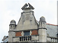
Former Barclays Bank, High Road / Broad Lane, N15 - date stone on corner gable
See Image
Image: © Mike Quinn
Taken: 7 Jun 2017
0.05 miles