IMAGES TAKEN NEAR TO
Stamford Road, LONDON, N15 4PY
Introduction
This page details the photographs taken nearby to Stamford Road, N15 4PY by members of the Geograph project.
The Geograph project started in 2005 with the aim of publishing, organising and preserving representative images for every square kilometre of Great Britain, Ireland and the Isle of Man.

There are currently over 7.5m images from over14,400 individuals and you can help contribute to the project by visiting https://www.geograph.org.uk
Image Map
Images are licensed for reuse under creativecommons.org/licenses/by-sa/2.0
Notes
- Clicking on the map will re-center to the selected point.
- The higher the marker number, the further away the image location is from the centre of the postcode.
Image Listing (127 Images Found)
Images are licensed for reuse under creativecommons.org/licenses/by-sa/2.0
Image
Details
Distance
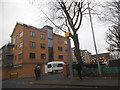
6
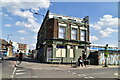
Broad Lane, N15 (2)
The north side, east of Antill Road.
Image: © Mike Quinn
Taken: 7 Jun 2017
0.07 miles
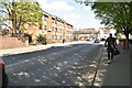
7
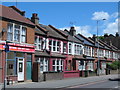
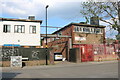
Mannion's public house, Tottenham Hale
Image: © Stacey Harris
Taken: 14 Jan 2012
0.07 miles
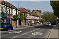
8

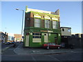
Mural on Markfield Road, Tottenham Hale
Image: © David Howard
Taken: 19 May 2024
0.07 miles
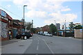
10
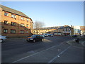
Businesses on Markfield Road, Tottenham Hale
Image: © David Howard
Taken: 19 May 2024
0.08 miles