IMAGES TAKEN NEAR TO
Avondale Road, LONDON, N15 3SL
Introduction
This page details the photographs taken nearby to Avondale Road, N15 3SL by members of the Geograph project.
The Geograph project started in 2005 with the aim of publishing, organising and preserving representative images for every square kilometre of Great Britain, Ireland and the Isle of Man.

There are currently over 7.5m images from over14,400 individuals and you can help contribute to the project by visiting https://www.geograph.org.uk
Image Map
Images are licensed for reuse under creativecommons.org/licenses/by-sa/2.0
Notes
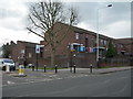
- Clicking on the map will re-center to the selected point.
- The higher the marker number, the further away the image location is from the centre of the postcode.
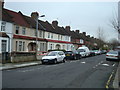
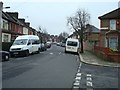
Image Listing (91 Images Found)
Images are licensed for reuse under creativecommons.org/licenses/by-sa/2.0
Image
Details
Distance
4
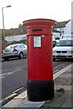
Victorian (VR) pillar box, Conway Road, London N15
Image: © Jim Osley
Taken: 21 Jan 2011
0.09 miles
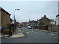
5
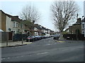
West Green Road at Woodlands Park Road, N15
Image: © Danny P Robinson
Taken: 21 Mar 2008
0.10 miles
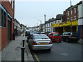
7

South Tottenham : Duck mural, Park Road
By James Stafford.
Image: © Jim Osley
Taken: 15 Jan 2021
0.12 miles
9

Salvation Army Citadel, South Tottenham
Built 1908.
Image: © Jim Osley
Taken: 20 Dec 2013
0.13 miles
10

Foundation stone, Salvation Army Citadel, South Tottenham
Image: © Jim Osley
Taken: 20 Dec 2013
0.13 miles