IMAGES TAKEN NEAR TO
Lincoln Avenue, LONDON, N14 7LL
Introduction
This page details the photographs taken nearby to Lincoln Avenue, N14 7LL by members of the Geograph project.
The Geograph project started in 2005 with the aim of publishing, organising and preserving representative images for every square kilometre of Great Britain, Ireland and the Isle of Man.

There are currently over 7.5m images from over14,400 individuals and you can help contribute to the project by visiting https://www.geograph.org.uk
Image Map
Images are licensed for reuse under creativecommons.org/licenses/by-sa/2.0
Notes
- Clicking on the map will re-center to the selected point.
- The higher the marker number, the further away the image location is from the centre of the postcode.
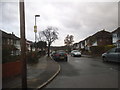
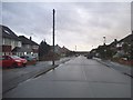
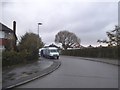
Image Listing (36 Images Found)
Images are licensed for reuse under creativecommons.org/licenses/by-sa/2.0
Image
Details
Distance
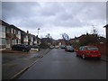
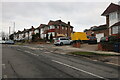
7
Hampden Way at the junction of Mandeville Road
Image: © David Howard
Taken: 18 Nov 2015
0.17 miles
9
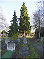
Gravestones, Cemetery, Waterfall Road, London N14
Looking east towards Old Southgate.
Image: © Christine Matthews
Taken: 10 Dec 2008
0.19 miles
10
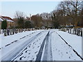
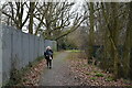
Waterfall Road Cemetery, London N14
Looking along the path in Waterfall Road Cemetery towards Southgate.
Image: © Christine Matthews
Taken: 18 Dec 2009
0.19 miles