1
Cycle Track, Bramley Road, London N14
Cycle Track in Bramley Road (A110) as seen from opposite the entrance to the Minchenden Association Clubhouse. This one is actually being used by a cyclist, the first time I have seen it in use.
Image: © Christine Matthews
Taken: 29 Aug 2008
0.01 miles
2
299 bus on Bramley Road, Cockfosters
Image: © David Howard
Taken: 30 Apr 2008
0.01 miles
3
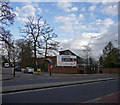
Minchenden Association Entrance with Clubhouse, Bramley Road, London N14
Minchenden Association Clubhouse as seen from Bramley Road (A110) with houses to the left.
Image: © Christine Matthews
Taken: 29 Aug 2008
0.02 miles
4
Pavement, Chase Side, London N14
Pavement on the north side of Chase Side adjacent to the Saracens Sports Ground. We are looking east.
Image: © Christine Matthews
Taken: 29 Mar 2009
0.02 miles
5
Cycle Track, Bramley Road, London N14
Cycle Track looking towards Cat Hill with the main Bramley Road (A110) on the left.
Image: © Christine Matthews
Taken: 29 Aug 2008
0.02 miles
6
Entrance to Minchenden Association Clubhouse, Bramley Road, London N14
Entrance to car park for the Minchenden Association Clubhouse, as seen from Bramley Road.
Image: © Christine Matthews
Taken: 29 Aug 2008
0.02 miles
7
Housing on Bramley Road
Housing is segregated from the busy A110, Bramley Road, by a hedge and trees, with access provided by a service road. The road on the left between the houses is Gloucester Gardens.
Image: © Martin Addison
Taken: 17 Apr 2009
0.03 miles
8
Cycle Track, Bramley Road, London N14
The cycle track in Bramley Road (A110) this time seen from closer to the Cat Hill Roundabout. The Saracens Rugby Football ground is on the left behind the hedge.
On the left of the image you can see what is now the car park for the Chicken Shed Theatre. Before the roundabout was constructed this was the route followed by the old Bramley Road at the end of which was a T junction with Chase Side and then after a right turn at the junction you would turn left down Cat Hill to get to Barnet.
Image: © Christine Matthews
Taken: 29 Aug 2008
0.03 miles
9
Cycle Track, Bramley Road, London N14
Looking towards Cat Hill, we have the cycle track in the centre of the image, as seen from the access road from the service road part of Bramley Road to the main Bramley Road (A110). In the centre of the image approximately you can see what is now used as a car park for the Chicken Shed Theatre, but which was the course of Bramley Road before the construction of the Cat Hill Roundabout.
Image: © Christine Matthews
Taken: 29 Aug 2008
0.03 miles
10
Chicken Shed Theatre, Chase Side, London N14
The Chicken Shed Theatre is in Chase Side close to the junction with Chase Road. It is actually situated on the corner of where Chase Road used to be and the old road is still used by the Chicken Shed as a car park. Chase Road was re-sited in the 1950s/1960s when the Cat Hill Roundabout was constructed.
Image: © Christine Matthews
Taken: 29 Mar 2009
0.03 miles


