IMAGES TAKEN NEAR TO
Priory Close, LONDON, N14 4AS
Introduction
This page details the photographs taken nearby to Priory Close, N14 4AS by members of the Geograph project.
The Geograph project started in 2005 with the aim of publishing, organising and preserving representative images for every square kilometre of Great Britain, Ireland and the Isle of Man.

There are currently over 7.5m images from over14,400 individuals and you can help contribute to the project by visiting https://www.geograph.org.uk
Image Map (Loading...)


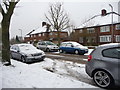
Getting Data...Please wait
Leaflet Map data © OpenStreetMap
Images are licensed for reuse under creativecommons.org/licenses/by-sa/2.0
Notes
- Clicking on the map will re-center to the selected point.
- The higher the marker number, the further away the image location is from the centre of the postcode.
Image Listing (103 Images Found)
Images are licensed for reuse under creativecommons.org/licenses/by-sa/2.0
Image
Details
Distance
1
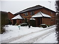
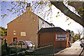
The Orchard, Bramley Road, N14
Showing the other side to the building to that shown in my other image with the grassy area in this image being where the orchard used to be.
Image: © Christine Matthews
Taken: 22 Jan 2006
0.05 miles
2
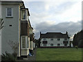
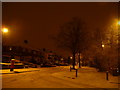
Priory Close, London N14
Priory Close is a turning off Green Road.
Image: © Christine Matthews
Taken: 11 Jan 2010
0.06 miles
3
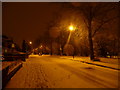
Green Road, London N14
Looking along Green Road when walking towards Chase Side.
Image: © Christine Matthews
Taken: 11 Jan 2010
0.06 miles
4
Vita et pax
Benedictine monastery and Catholic church of Christ the King.
Image: © Robin Webster
Taken: 25 Nov 2012
0.06 miles
5
Green Road, London N14
Looking along Green Road in the direction of Reservoir Road.
Image: © Christine Matthews
Taken: 11 Jan 2010
0.07 miles
6
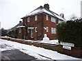
Flats in Green Road, London N14
These flats are on the north side of Green Road.
Image: © Christine Matthews
Taken: 11 Jan 2010
0.08 miles
7
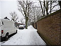
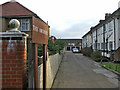
Bramley Road Service Road, London N14
Looking east along the Bramley Road service road.
Image: © Christine Matthews
Taken: 21 Dec 2009
0.08 miles
8
Entrance to the Orchard, Bramley Road, N14
Entrance to the Orchard development of maisonettes off Bramley Road, N14. Behind the buildings on the right there is grassy area where up to a few years ago the original orchard trees remained. Sadly the trees were old and needed to be removed.
Image: © Christine Matthews
Taken: 22 Jan 2006
0.08 miles
9
Bramley Road Service Road, London N14
Bramley Road service road near the access road from Bramley Road (A110).
Image: © Christine Matthews
Taken: 21 Dec 2009
0.10 miles
10
Angling Shop, Reservoir Road, London N14
As can be seen from this sideways view, this shop, Oakwood Angling, is a fairly new building on the front of what was originally a cottage.
Image: © Christine Matthews
Taken: 9 Oct 2008
0.11 miles