IMAGES TAKEN NEAR TO
Riverway, LONDON, N13 5LL
Introduction
This page details the photographs taken nearby to Riverway, N13 5LL by members of the Geograph project.
The Geograph project started in 2005 with the aim of publishing, organising and preserving representative images for every square kilometre of Great Britain, Ireland and the Isle of Man.

There are currently over 7.5m images from over14,400 individuals and you can help contribute to the project by visiting https://www.geograph.org.uk
Image Map
Images are licensed for reuse under creativecommons.org/licenses/by-sa/2.0
Notes
- Clicking on the map will re-center to the selected point.
- The higher the marker number, the further away the image location is from the centre of the postcode.
Image Listing (168 Images Found)
Images are licensed for reuse under creativecommons.org/licenses/by-sa/2.0
Image
Details
Distance
1
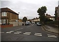
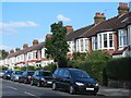
Hamilton Crescent at the junction of Riverway
Image: © David Howard
Taken: 16 Oct 2014
0.03 miles
3
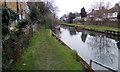
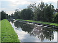
The New River east of Oakthorpe Road, N13
See Image
Image: © Mike Quinn
Taken: 9 Sep 2015
0.05 miles
5
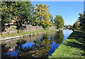
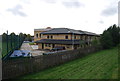
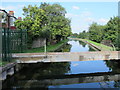
The New River at Oakthorpe Road
The New River has been delivering water to London since 1613, and still supplies around 8% of the capital's requirements.
Image: © Des Blenkinsopp
Taken: 9 Oct 2018
0.06 miles
6
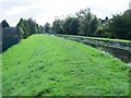
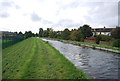
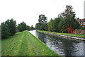
The New River north of Chimes Avenue, N13
See Image This stretch of the New River is contained by quite a high embankment on its eastern side.
Image: © Mike Quinn
Taken: 9 Sep 2015
0.06 miles