IMAGES TAKEN NEAR TO
Green Lanes, LONDON, N13 4EB
Introduction
This page details the photographs taken nearby to Green Lanes, N13 4EB by members of the Geograph project.
The Geograph project started in 2005 with the aim of publishing, organising and preserving representative images for every square kilometre of Great Britain, Ireland and the Isle of Man.

There are currently over 7.5m images from over14,400 individuals and you can help contribute to the project by visiting https://www.geograph.org.uk
Image Map
Images are licensed for reuse under creativecommons.org/licenses/by-sa/2.0
Notes
- Clicking on the map will re-center to the selected point.
- The higher the marker number, the further away the image location is from the centre of the postcode.
Image Listing (205 Images Found)
Images are licensed for reuse under creativecommons.org/licenses/by-sa/2.0
Image
Details
Distance
9
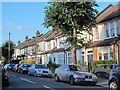
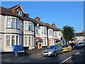
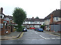
River Avenue, N13 (4)
The east side, north of Greenwood Gardens. The New River runs behind these houses.
Image: © Mike Quinn
Taken: 9 Sep 2015
0.05 miles