IMAGES TAKEN NEAR TO
Alwyne Road, LONDON, N1 2HW

Introduction

This page details the photographs taken nearby to Alwyne Road, N1 2HW by members of the Geograph project.

The Geograph project started in 2005 with the aim of publishing, organising and preserving representative images for every square kilometre of Great Britain, Ireland and the Isle of Man.

There are currently over 7.5m images from over14,400 individuals and you can help contribute to the project by visiting https://www.geograph.org.uk

Image Map


Images are licensed for reuse under creativecommons.org/licenses/by-sa/2.0
Notes
  • Clicking on the map will re-center to the selected point.
  • The higher the marker number, the further away the image location is from the centre of the postcode.

Image Listing (220 Images Found)

Images are licensed for reuse under creativecommons.org/licenses/by-sa/2.0
  • ...
Image
Details
Distance
1
The "New River" and houses in Alwyne Road
See Image
Image: © Mike Quinn Taken: 11 Mar 2015
0.01 miles
2
New River Walk
Image: © N Chadwick Taken: 20 Oct 2013
0.02 miles
3
The "New River" by Canonbury Grove, N1 (5)
See Image
Image: © Mike Quinn Taken: 11 Mar 2015
0.02 miles
4
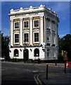
Marquess Tavern, Canonbury (1848)
Grade II listed mid-nineteenth century public house described here http://www.britishlistedbuildings.co.uk/en-368688-marquess-tavern-public-house-32-islingto
Image: © Jim Osley Taken: 20 Jun 2012
0.02 miles
5
The "New River" by Canonbury Grove, N1 (6)
See Image
Image: © Mike Quinn Taken: 11 Mar 2015
0.02 miles
6
The "New River" by Canonbury Grove, N1 (3)
See Image
Image: © Mike Quinn Taken: 11 Mar 2015
0.02 miles
7
New River Walk, Canonbury
The New River was completed between 1609 and its official opening on 29th September 1613. It was designed to bring clean water to London at a time when the heavily-polluted River Thames was the main source of drinking water. It ran from near Ware in Hertfordshire to New River Head near the Angel, Islington but now finishes at Stoke Newington. The New River remains an essential part of London’s water supply. The part to the south of Stoke Newington, where it survives as here at the New River Walk in Canonbury, is more like a linear pond and does not have flowing water. The New River Walk is an attractive path alongside the water at all seasons of the year. Here, Canonbury Grove is to the right. A very interesting web site with photographs can be seen at http://www.londonslostrivers.com/the-new-river.html See also the information board at https://www.geograph.org.uk/photo/7014300
Image: © Marathon Taken: 26 Nov 2014
0.03 miles
8
The "New River" by Canonbury Grove, N1 (7)
See Image
Image: © Mike Quinn Taken: 11 Mar 2015
0.03 miles
9
Cut bench mark on wall of 1A Alwyne Place
See http://www.geograph.org.uk/photo/3026029 for a wider view and http://www.bench-marks.org.uk/bm43795 for details of bench mark.
Image: © Brian Westlake Taken: 26 May 2012
0.03 miles
10
1A Alwyne Place
The left-hand pillar carries a cut bench mark. See http://www.geograph.org.uk/photo/3026025 for a close-up.
Image: © Brian Westlake Taken: 26 May 2012
0.03 miles
  • ...