IMAGES TAKEN NEAR TO
Chiddingfold, LONDON, N12 7EY
Introduction
This page details the photographs taken nearby to Chiddingfold, N12 7EY by members of the Geograph project.
The Geograph project started in 2005 with the aim of publishing, organising and preserving representative images for every square kilometre of Great Britain, Ireland and the Isle of Man.

There are currently over 7.5m images from over14,400 individuals and you can help contribute to the project by visiting https://www.geograph.org.uk
Image Map
Images are licensed for reuse under creativecommons.org/licenses/by-sa/2.0
Notes
- Clicking on the map will re-center to the selected point.
- The higher the marker number, the further away the image location is from the centre of the postcode.
Image Listing (37 Images Found)
Images are licensed for reuse under creativecommons.org/licenses/by-sa/2.0
Image
Details
Distance
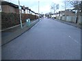
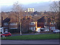
5
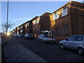
Housing along Southover, Woodside Park
These are maisonettes but some are being used as offices.
Image: © David Howard
Taken: 16 Jan 2008
0.09 miles
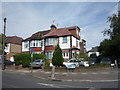
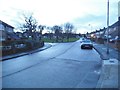
6
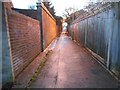
Path from Chiddingfold to Southover, Woodside Park
Image: © David Howard
Taken: 23 Jan 2014
0.09 miles
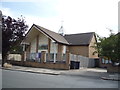
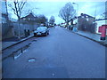
7
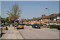
Southover
Suburban street leading up to Laurel Farm.
Image: © Martin Addison
Taken: 19 Apr 2011
0.10 miles