IMAGES TAKEN NEAR TO
Cissbury Ring South, LONDON, N12 7BD
Introduction
This page details the photographs taken nearby to Cissbury Ring South, N12 7BD by members of the Geograph project.
The Geograph project started in 2005 with the aim of publishing, organising and preserving representative images for every square kilometre of Great Britain, Ireland and the Isle of Man.

There are currently over 7.5m images from over14,400 individuals and you can help contribute to the project by visiting https://www.geograph.org.uk
Image Map
Images are licensed for reuse under creativecommons.org/licenses/by-sa/2.0
Notes
- Clicking on the map will re-center to the selected point.
- The higher the marker number, the further away the image location is from the centre of the postcode.
Image Listing (20 Images Found)
Images are licensed for reuse under creativecommons.org/licenses/by-sa/2.0
Image
Details
Distance
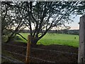
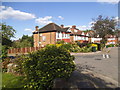
2
Field behind Lullington Garth, Woodside Park
This is one of the closest parts of London where the houses end and fields begin, these extend northwest to beyond the border outside the urban area completely in Arkley.
Image: © David Howard
Taken: 28 Oct 2009
0.13 miles
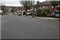
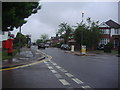
5
Cissbury Ring North at the junction of Scaynes Link
Image: © David Howard
Taken: 5 Jun 2014
0.15 miles
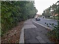
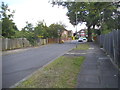
6
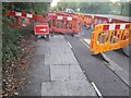
Pavement works on Lullington Garth, Woodside Park
Image: © David Howard
Taken: 23 Sep 2021
0.18 miles
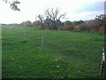
7
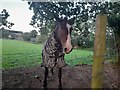
Horse in Woodside Park
Lullington Garth covers the edge of suburban London and beyond is all farming.
Image: © David Howard
Taken: 23 Sep 2021
0.18 miles
9
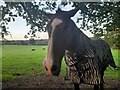
Horse in Woodside Park
This is the fully rural part of London
Image: © David Howard
Taken: 23 Sep 2021
0.19 miles