IMAGES TAKEN NEAR TO
Telford Road, LONDON, N11 2RS
Introduction
This page details the photographs taken nearby to Telford Road, N11 2RS by members of the Geograph project.
The Geograph project started in 2005 with the aim of publishing, organising and preserving representative images for every square kilometre of Great Britain, Ireland and the Isle of Man.

There are currently over 7.5m images from over14,400 individuals and you can help contribute to the project by visiting https://www.geograph.org.uk
Image Map
Images are licensed for reuse under creativecommons.org/licenses/by-sa/2.0
Notes
- Clicking on the map will re-center to the selected point.
- The higher the marker number, the further away the image location is from the centre of the postcode.
Image Listing (69 Images Found)
Images are licensed for reuse under creativecommons.org/licenses/by-sa/2.0
Image
Details
Distance
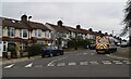
3
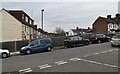
Evesham Road from Telford Road, Bounds Green
Image: © David Howard
Taken: 21 Jan 2019
0.05 miles
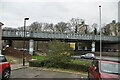
7
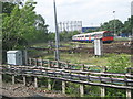
Tube sidings south of Arnos Grove station (2)
Image: © Mike Quinn
Taken: 12 May 2009
0.07 miles
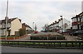
8
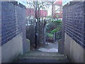
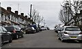
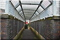
Exit from path to Lower Maidstone Road
This crosses the railway from Stoneham Road
Image: © David Howard
Taken: 3 Dec 2008
0.07 miles
10
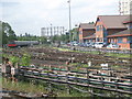
Tube sidings south of Arnos Grove station
Image: © Mike Quinn
Taken: 12 May 2009
0.08 miles