IMAGES TAKEN NEAR TO
Ring Way, LONDON, N11 2NB
Introduction
This page details the photographs taken nearby to Ring Way, N11 2NB by members of the Geograph project.
The Geograph project started in 2005 with the aim of publishing, organising and preserving representative images for every square kilometre of Great Britain, Ireland and the Isle of Man.

There are currently over 7.5m images from over14,400 individuals and you can help contribute to the project by visiting https://www.geograph.org.uk
Image Map
Images are licensed for reuse under creativecommons.org/licenses/by-sa/2.0
Notes
- Clicking on the map will re-center to the selected point.
- The higher the marker number, the further away the image location is from the centre of the postcode.
Image Listing (49 Images Found)
Images are licensed for reuse under creativecommons.org/licenses/by-sa/2.0
Image
Details
Distance
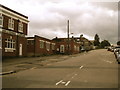
1

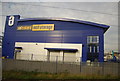
Part of Ring Way Industrial Estate by the ECML
Image: © N Chadwick
Taken: 25 Feb 2011
0.09 miles
2
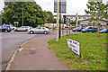
Road sign, Station Road, London N11
The road sign on the corner of Station Road and the North Circular Road indicates that Station Road was formerly called the High Road. The traffic on the North Circular Road travelling east from Pinkham Way on the right to Telfort Road on the left just outside the image.
Image: © Christine Matthews
Taken: 16 Aug 2008
0.09 miles
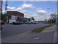
3
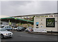
Petrol Station on Pinkham Way
This BP petrol station with its accompanying Marks and Spencer convenience store is on the south side of Pimkham Way which is the main road from Finchley to Southgate
Image: © Nigel Mykura
Taken: 23 Aug 2014
0.09 miles
7
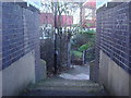
Exit from path to Lower Maidstone Road
This crosses the railway from Stoneham Road
Image: © David Howard
Taken: 3 Dec 2008
0.10 miles
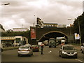
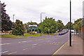
8
North Circular Road eastbound at New Southgate
Image: © David Howard
Taken: 9 Apr 2008
0.11 miles
9
Station Road, London N11 (A109)
Looking down Station Road towards the junction with the North Circular Road (A406) and the Bounds Green Road.
Image: © Christine Matthews
Taken: 16 Aug 2008
0.11 miles
10
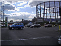
North Circular Road at junction of A109 Bounds Green
With prominent gas holder
Image: © David Howard
Taken: 9 Apr 2008
0.11 miles