1
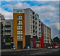
Station Road, London N11 (A109)
Looking down Station Road towards the North Circular Road, taken from near Homebase.
Image: © Christine Matthews
Taken: 16 Aug 2008
0.02 miles
2
Pavement, Station Road, London N11
Looking north along the pavement of Station Road. The bus stop near Homebase can be seen on the left.
Image: © Christine Matthews
Taken: 16 Aug 2008
0.03 miles
3
Industrial Estate, New Southgate
Industrial units located on Lower Park, beside the Ladderswood Estate. Behind, is a gasometer located beside the junction of Station Road and the North Circular Road - I believe it is out of use.
Image: © Martin Addison
Taken: 25 Sep 2009
0.04 miles
4
Tube sidings south of Arnos Grove station (2)
Image: © Mike Quinn
Taken: 12 May 2009
0.04 miles
5
Station Road, London N11 (A109)
Looking down Station Road towards the junction with the North Circular Road (A406) and the Bounds Green Road.
Image: © Christine Matthews
Taken: 16 Aug 2008
0.05 miles
6
New Southgate : new buildings, Montmorency Park
Image: © Jim Osley
Taken: 3 Sep 2021
0.05 miles
7
Gasometer on corner North Circular Road and Station Road, London N11
This gasometer on the corner of the North Circular Road (A406) and Station Road (A109) is quite a landmark and something I always looked at when I was in an underground train travelling towards Arnos Grove from Bounds Green having just come out of the tunnel. I believe it is a listed structure.
Image: © Christine Matthews
Taken: 16 Aug 2008
0.05 miles
8
Tower Block, Station Road, London N11
As seen from outside the Homebase Store.
Image: © Christine Matthews
Taken: 10 Dec 2011
0.06 miles
9
Phone Mast next to gasometer on corner North Circular Road and Station Road, London N11
An old and a more modern industrial structure on the corner of the North Circular Road (A406) and Station Road (A109).
Image: © Christine Matthews
Taken: 16 Aug 2008
0.06 miles
10
Gasometer and Phone Mast
Image: © Chris Whippet
Taken: 12 Aug 2008
0.06 miles


