IMAGES TAKEN NEAR TO
Bryan Street, LONDON, N1 0UB
Introduction
This page details the photographs taken nearby to Bryan Street, N1 0UB by members of the Geograph project.
The Geograph project started in 2005 with the aim of publishing, organising and preserving representative images for every square kilometre of Great Britain, Ireland and the Isle of Man.

There are currently over 7.5m images from over14,400 individuals and you can help contribute to the project by visiting https://www.geograph.org.uk
Image Map
Images are licensed for reuse under creativecommons.org/licenses/by-sa/2.0
Notes
- Clicking on the map will re-center to the selected point.
- The higher the marker number, the further away the image location is from the centre of the postcode.
Image Listing (330 Images Found)
Images are licensed for reuse under creativecommons.org/licenses/by-sa/2.0
Image
Details
Distance
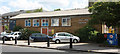
5

Mosaic, Thornhill Bridge Community Garden
Image: © Jim Osley
Taken: 20 Nov 2013
0.03 miles

7

Steps to Caledonian Road
These steps lead up from the Regent's Canal towpath on the western side of the Caledonian Road bridge through a small garden.
Image: © Stephen McKay
Taken: 11 Nov 2008
0.04 miles
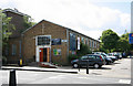
8

Caledonian Road looking south
From the Caledonian Road Copenhagen Street bus stop. Copenhagen Street is the intersecting road.
Image: © Robin Webster
Taken: 5 Feb 2011
0.04 miles

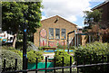
10

Pathway between All Saints Church and the Regent's Canal
Image: © John Salmon
Taken: 9 May 2011
0.05 miles