1
Paget Christian Centre, Islington
Strange triangular wedge shaped church building on the junction of Rufford Street and Randell's Road (on the right).
Was formerly the Paget Memorial Mission Hall. It is Grade II listed.
See http://www.britishlistedbuildings.co.uk/en-369209-paget-memorial-mission-hall-and-ancillar for more details about the former Hall.
See http://en.wikipedia.org/wiki/Arthur_Beresford_Pite for details on the architect.
Image: © David Anstiss
Taken: 10 Mar 2013
0.05 miles
2
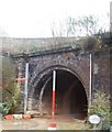
Railway tunnel, northern end
Image: © N Chadwick
Taken: 21 Feb 2011
0.06 miles
3
The last tunnel south before Kings Cross railway station
Image: © Steve Fareham
Taken: 27 Oct 2007
0.07 miles
4
York Road Underground Station
York Road Station, near King's Cross is one of six disused London Underground stations designed by the architect Leslie Green (1875-1908), the others being Aldwych, Brompton Road, Down Street, Euston and South Kentish Town. York Road opened in 1906 and closed in 1932. The ox-blood red faience cladding characterizes Green's stations, and there are about 40 in all.
Other examples are:
Image]
Image]
Image]
Image]
Image]
Image]
Image
For a full account of the work of Leslie Green see Leboff, David: The Underground stations of Leslie Green. London: Capital Transport, 2002.
Image: © Jim Osley
Taken: 2 Feb 2014
0.08 miles
5
The (former) York Road tube station, York Way / Bingfield Street, N1 - north side
York Road station, between Kings’ Cross and Caledonian Road stations, opened in December 1906 at the corner of York Road (now York Way) and Bingfield Street. In 1909 the Piccadilly line decided to let some trains pass through some of the lesser-used stations without stopping; these included York Road. Sunday services were withdrawn in 1918 and the station was closed for public use in September 1932. The street level building became derelict, but was renovated in 1989 revealing the station’s name and the entrance and exit signs. With the massive redevelopment in the King’s Cross area, there is a possibility that the station might be re-opened - see http://en.wikipedia.org/wiki/York_Road_tube_station .
Image: © Mike Quinn
Taken: 9 Feb 2011
0.08 miles
6
Play Area, Wellington Square
Image: © Alex McGregor
Taken: 4 Jan 2012
0.08 miles
7
York Road Underground Station
The building that housed the York Road underground station, on the Piccadilly Line between Caledonian Road and Kings Cross St Pancras. The station was operational between 1906 and 1932.
Image: © Alistair Stewart
Taken: 19 Jan 2019
0.08 miles
8
The (former) York Road tube station, York Way / Bingfield Street, N1
York Road station, between Kings’ Cross and Caledonian Road stations, opened in December 1906 at the corner of York Road (now York Way) and Bingfield Street. In 1909 the Piccadilly line decided to let some trains pass through some of the lesser-used stations without stopping; these included York Road. Sunday services were withdrawn in 1918 and the station was closed for public use in September 1932. The street level building became derelict, but was renovated in 1989 revealing the station’s name and the entrance and exit signs. With the massive redevelopment in the King’s Cross area, there is a possibility that the station might be re-opened - see http://en.wikipedia.org/wiki/York_Road_tube_station .
Image: © Mike Quinn
Taken: 9 Feb 2011
0.08 miles
9
Businesses on Randell's Road, Somers Town
Most people call the area King's Cross now but that is just the name of the station, the area was always called Somers Town officially.
Image: © David Howard
Taken: 28 Aug 2014
0.08 miles
10
York Road Underground station (site), London
Opened in 1906 by the Great Northern, Piccadilly & Brompton Railway on what is today the Piccadilly Line of London Underground, this station closed in 1932.
View east from York Road. Underground trains pass through the site without stopping.
Image: © Nigel Thompson
Taken: 20 Jan 2023
0.08 miles


