IMAGES TAKEN NEAR TO
Muswell Road, LONDON, N10 2BX
Introduction
This page details the photographs taken nearby to Muswell Road, N10 2BX by members of the Geograph project.
The Geograph project started in 2005 with the aim of publishing, organising and preserving representative images for every square kilometre of Great Britain, Ireland and the Isle of Man.

There are currently over 7.5m images from over14,400 individuals and you can help contribute to the project by visiting https://www.geograph.org.uk
Image Map (116 Images)


Getting Data...Please wait
Leaflet Map data © OpenStreetMap
Images are licensed for reuse under creativecommons.org/licenses/by-sa/2.0
Notes
- Clicking on the map will re-center to the selected point.
- The higher the marker number, the further away the image location is from the centre of the postcode.
Image Listing (116 Images Found)
Images are licensed for reuse under creativecommons.org/licenses/by-sa/2.0
Image
Details
Distance
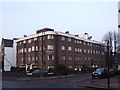
1
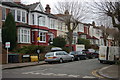
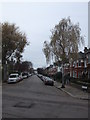
Muswell Road N10
At the junction of Methuen Park
Image: © Robin Sones
Taken: 23 Nov 2011
0.02 miles
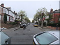
2
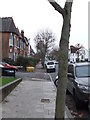
Curzon Road N10
From the junction with Muswell Road
Image: © Robin Sones
Taken: 23 Nov 2011
0.05 miles
3
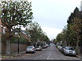
Coniston Road N10
From the junction with Muswell Road
Image: © Robin Sones
Taken: 23 Nov 2011
0.06 miles
4
Donovan Avenue N10
At the junction with Rosebery Road
Image: © Robin Sones
Taken: 23 Nov 2011
0.10 miles
5
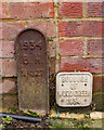
Muswell Hill : Borough boundary markers
Where the Borough of Hornsey met the Borough of Wood Green.
Image: © Jim Osley
Taken: 5 Dec 2020
0.11 miles
6
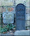
Muswell Hill : borough boundary markers
B.H. stands for Borough of Hornsey.
Image: © Jim Osley
Taken: 4 Dec 2020
0.11 miles
7
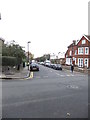
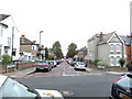
Muswell Avenue N10
From the junction with Muswell Road
Image: © Robin Sones
Taken: 23 Nov 2011
0.11 miles
9
Methuen Park N10
At the junction with Dukes Avenue
Image: © Robin Sones
Taken: 23 Nov 2011
0.13 miles