
IMAGES TAKEN NEAR TO
Stonehouse, LARKHALL, ML9 3PH
Introduction
This page details the photographs taken nearby to ML9 3PH by members of the Geograph project.
The Geograph project started in 2005 with the aim of publishing, organising and preserving representative images for every square kilometre of Great Britain, Ireland and the Isle of Man.

There are currently over 7.5m images from over14,400 individuals and you can help contribute to the project by visiting https://www.geograph.org.uk
Image Map
Images are licensed for reuse under creativecommons.org/licenses/by-sa/2.0
Notes
- Clicking on the map will re-center to the selected point.
- The higher the marker number, the further away the image location is from the centre of the postcode.
Image Listing (5 Images Found)
Images are licensed for reuse under creativecommons.org/licenses/by-sa/2.0
Image
Details
Distance
1
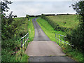
Watstone Road, Stonehouse
A single track road to Watstone. The bridge takes the road over the Watstone Burn and the sign near the top of the hill warns drivers to keep off the soft grass verges.
Image: © wrobison
Taken: 8 Sep 2020
0.16 miles
3
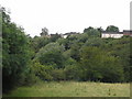
Stonehouse from side of Cander Water
A little corner of Stonehouse from the side of the Cander Water. Conditions very wet and overcast, very wet underfoot.
Image: © James K Muldoon
Taken: 12 Aug 2007
0.20 miles
4
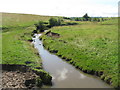
Watstone Burn
Just outside Stonehouse, the Watstone Burn is a tributary of the Cander Water.
Image: © G Laird
Taken: 16 Aug 2013
0.22 miles
5
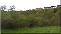
Below Stonehouse
Much of Lanarkshire is a plateau with the River Clyde running some distance below the normal land level. As a result there are numerous steep valleys and gorges formed as tributaries (here the Watstone Burn) cut down to Clyde level.
Image: © Richard Webb
Taken: 24 Apr 2012
0.22 miles