1
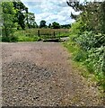
Park, Allanton
Between Redmyre Crescent and the Allanton Primary School.
Image: © Richard Webb
Taken: 16 Sep 2010
0.05 miles
2
Footbridge over small stream
On path network connecting the different parts of Allanton
Image: © Jim Smillie
Taken: 18 Jun 2021
0.16 miles
3
Barn Ruin at Redmire
It is nice to still see national speed limit signs on a road on which no sane driver would ever approach the national speed limit. In this part of North Lanarkshire all 60mph roadsigns have been downgraded to 50mph roadsigns in recent years - this one must have gone under the radar.
It is one of the most misunderstood road signs by motorists, due to it not explicitly stating the speed limit on the road. For cars it means 60mph on a single carriageway road, and 70mph on a dual carriageway. This causes further confusion for many of the few who actually get what the sign means. Because most dual carriageways, excluding motorways, are two lanes on each side, most motorists wrongly assume that the presence of two lanes running side by side in the same direction is what the 'dual' bit refers to. However, single lane dual carriageways are a thing. The 'dual' bit means that the two carriageways, or halves of the road, are separated by a barrier, making it impossible to cross into the path of oncoming traffic, which due to the laws of physics makes accidents more deadly. This is why the speed limit on a dual carriageway is higher, and one of the factors that makes deaths on motorways per mile driven extremely low.
The design of the sign may initially appear confusing, but it is really just crossing out any previously stated speed limit. It makes more sense when you know that only built-up areas used to have speed limits - until 1965 there was actually no upper speed limit outside speed limited areas.
To me it always just means use your common sense!
The ruin is never shown on old maps as inhabited, even when it had a roof, and is the only building of Redmire on the Eastern side of Old Mill Road. The stones on top of the lintel look very precarious indeed. A wire fence forms a tiny field around the ruin. I wondered if this was due to the state of the ruin - cows and sheep often share fields round here, but maybe a cow might cause a stone to fall? There were just three sheep in the tiny field when I passed it.
Image: © Ian Dodds
Taken: 13 Jun 2021
0.21 miles
4
East Redmire
On Allanton Road at Old Mill Road junction.
Image: © Jim Smillie
Taken: 12 Oct 2009
0.21 miles
5
Abandoned Barn Rear View - Old Mill Road - Allanton
Rear view of the abandoned barn in Allanton
Image: © M22RDY
Taken: 16 Mar 2008
0.24 miles
6
Pond at North Edge of Kingshill Local Nature Reserve
Kingshill Nature Reserve is essentially situated on the grounds of the former Kingshill Colliery, situated just South of the village of Allanton, by neccesity as much as anything else. Due to the damage done by the mining operations, along with the fact that the mine was situated in a peat bog, there is little chance of this land having the potential to be used for profitable farming or residential use anytime soon. This isn't meant to sound scathing - the fact is that, quite rightly, these days spoiled land must be made better by whichever council oversees it. So North Lanarkshire Council have to do their best with whatever they have been left with, which in this case isn't a great deal. Not that it's a bad place, it's just run-of-the-mill countryside now termed a nature reserve! This largish pond is, in my opinion, its best feature.
The pond is roughly in the same position of one of the mine ponds shown on a 1950s OS map, when the mine was still operational.
Image: © Ian Dodds
Taken: 12 Jun 2021
0.24 miles
7
Abandoned Barn - Old Mill Road - Allanton
This barn can be seen on the left from Allanton Road, the barn is situated just before the road splits into a dual carriageway.
Image: © M22RDY
Taken: 16 Mar 2008
0.24 miles


