
IMAGES TAKEN NEAR TO
Moncrieffe Road, AIRDRIE, ML6 8FS
Introduction
This page details the photographs taken nearby to Moncrieffe Road, ML6 8FS by members of the Geograph project.
The Geograph project started in 2005 with the aim of publishing, organising and preserving representative images for every square kilometre of Great Britain, Ireland and the Isle of Man.

There are currently over 7.5m images from over14,400 individuals and you can help contribute to the project by visiting https://www.geograph.org.uk
Image Map
Images are licensed for reuse under creativecommons.org/licenses/by-sa/2.0
Notes
- Clicking on the map will re-center to the selected point.
- The higher the marker number, the further away the image location is from the centre of the postcode.
Image Listing (18 Images Found)
Images are licensed for reuse under creativecommons.org/licenses/by-sa/2.0
Image
Details
Distance
1
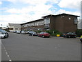
Chapelhall Industrial Estate
Looking north along Stirling Road.
Image: © G Laird
Taken: 5 Aug 2011
0.05 miles
2
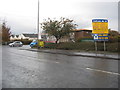
Chapelhall Industrial Estate
In Chapelhall south of Airdrie in Lanarkshire.
Image: © James Denham
Taken: 2 Nov 2013
0.12 miles
3
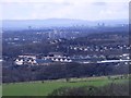
Chapelhall Industrial Estate
With the urban sprawl of Coatbridge and Greater Glasgow beyond.
Image: © Robert Murray
Taken: 4 Mar 2012
0.13 miles
4
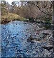
North Calder at Monkland Bridge
North Calder flows in from left at its confluence with Shotts Burn
Image: © Jim Smillie
Taken: 12 Apr 2021
0.14 miles
5
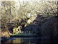
North Calder Water
Taken from the river bed - which here in low water is about ankle deep - at its confluence with the Shotts Burn. The North Calder is on the left coming from the Monkland Glen and the Shotts Burn comes from the right after flowing under an old single arch span called Blackhouse Bridge (under threat of demolition due to its condition). For photo of the latter and local rambler Jim Casssidy's single handed campaign to save it see http://airdrierambler.wordpress.com/2011/03/04/right-of-way-under-threat-gartness-to-monklands-bridge/
Image: © Robert Murray
Taken: 4 Mar 2012
0.14 miles
7
![Airdrie, Monkland Bridge [3]](https://s0.geograph.org.uk/geophotos/02/83/72/2837260_e125c7ed_120x120.jpg)
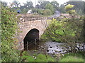
Airdrie, Monkland Bridge [3]
View which reveals the two bridges with the original spectacular single arch span over the river and its bolted on modern concrete addition. An easy and cheap low level crossing could easily have been made across this river just a short distance to the west had the Laird of Monkland House been willing to permit such.
Image: © Robert Murray
Taken: 4 Mar 2012
0.17 miles
8
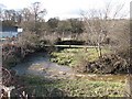
Shotts Burn
Shotts Burn passing Chapelhall water treatment works.
Image: © Richard Webb
Taken: 1 Apr 2010
0.18 miles
9
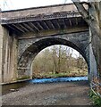
Monkland Bridge
Carries A73 between Chapelhall and Airdrie.
Arched section would appears to be the original when road was narrower.
Image: © Jim Smillie
Taken: 12 Apr 2021
0.18 miles
10
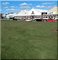
Chapelhall Industrial Estate
These units are more or less original from the late 1940's
Image: © Jim Smillie
Taken: 12 Apr 2021
0.18 miles