IMAGES TAKEN NEAR TO
Ballochney Road, AIRDRIE, ML6 7HZ

Introduction

This page details the photographs taken nearby to Ballochney Road, ML6 7HZ by members of the Geograph project.

The Geograph project started in 2005 with the aim of publishing, organising and preserving representative images for every square kilometre of Great Britain, Ireland and the Isle of Man.

There are currently over 7.5m images from over14,400 individuals and you can help contribute to the project by visiting https://www.geograph.org.uk

Image Map


Images are licensed for reuse under creativecommons.org/licenses/by-sa/2.0
Notes
  • Clicking on the map will re-center to the selected point.
  • The higher the marker number, the further away the image location is from the centre of the postcode.

Image Listing (10 Images Found)

Images are licensed for reuse under creativecommons.org/licenses/by-sa/2.0
Image
Details
Distance
1
Approaching Meadowhead
Meadowhead is on the left. The sign on the right is for Drumshangie Woodland Walk. There really isn't much to photograph in this grid square unless you like former opencast mines and housing estates.
Image: © Texas Radio and The Big Beat Taken: 11 Apr 2010
0.05 miles
2
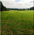
Silage has been lifted
Large grass field at Meadowhead
Image: © Jim Smillie Taken: 14 Jul 2021
0.07 miles
3
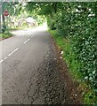
Junction on Ballochney Road
There is a stop sign but going straight ahead continues as Ballochney Road
Image: © Jim Smillie Taken: 14 Jul 2021
0.10 miles
4
Leaving Plains to the North
At a mini-roundabout on Meadowhead Road.
Image: © G Laird Taken: 20 Jun 2012
0.10 miles
5
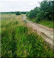
Track north of Ballochney Road
Leading into area of reclaimed opencast
Image: © Jim Smillie Taken: 14 Jul 2021
0.11 miles
6
House at Airdriehill
The House stands on a knoll and must have had an excellent view over all the opencast mines and industrial buildings that once stood in the vicinity.
Image: © Anne Burgess Taken: 24 Aug 2013
0.19 miles
7
Ruin, Airdriehill
Substantial ruin and mobile 'phone mast.
Image: © Richard Webb Taken: 25 Jul 2008
0.21 miles
8
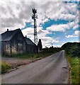
The old with the new
A mobile phone mast beside a chapel and school ruin which is over 100 years old
Image: © Jim Smillie Taken: 14 Jul 2021
0.21 miles
9
Airdriehill, derelict building
O.S. map of the 1920s refer to this building as St. David's RC Chapel & School. See Image for further information.
Image: © Robert Murray Taken: 11 Jun 2011
0.22 miles
10
Airdriehill, reinstated land
Grassland in the foreground but poorly reinstated land further out. Within the confines of this photo there once stood Stanrigg Oil works which stood alongside the Ballochney Railway.
Image: © Robert Murray Taken: 11 Jun 2011
0.23 miles