1
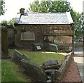
A scene at Glenmavis in North Lanarkshire
As a village road heads past the old kirk and kirkyard.
Image: © James Denham
Taken: 20 Apr 2013
0.03 miles
2
Glenmavis Cemetery
This vast cemetery extends northwards from the original New Monkland parish kirkyard at Glenmavis.
Image: © Anne Burgess
Taken: 24 Aug 2013
0.06 miles
3
Watch House, New Monkland Church
At the gates of New Monkland Parish Church.
Legend has it that night watchmen kept guard against bodysnatchers from here.
The chimney is still intact but unfortunately the roof is not.
The roof has now been replaced www.geograph.org.uk/photo/1951526
Image: © Texas Radio and The Big Beat
Taken: 24 May 2009
0.08 miles
4
New Monkland Cemetery
This vast cemetery extends northwards from the original New Monkland parish kirkyard at Glenmavis. On the right is the wall that separates the cemetery from the kirkyard.
Image: © Anne Burgess
Taken: 24 Aug 2013
0.09 miles
5
Watch House, New Monkland Church
Recently re-roofed and looking splendid.
Compare to picture from May 2009 www.geograph.org.uk/photo/1602708
Image: © Texas Radio and The Big Beat
Taken: 7 Jul 2010
0.09 miles
6
New Monkland Parish Kirk
The kirk and kirkyard are at Glenmavis, a mile or so from Airdrie. Originally built in about 1650, a single-storey building with a short steeple, the kirk was heightened in 1777, making the old steeple look a bit odd. Or was it? The Royal Commission on the Ancient and Historic Monuments of Scotland questions the alleged antiquity of the steeple, saying that its construction is similar to the rest of the 1777 stonework. Its stone used to be blackened by pollution from local heavy industry, earning it the nickname, 'The Auld Grey Kirk on the hill' but with the improvement in air quality the sandstone is reverting to a more natural colour.
Image: © Anne Burgess
Taken: 10 Jul 2014
0.09 miles
7
New Monkland Parish Church & Churchyard
Image: © Texas Radio and The Big Beat
Taken: 24 May 2009
0.10 miles
8
New Monkland Parish Church
New Monkland Parish Church, Glenmavis.
Image: © Iain Thompson
Taken: 16 Apr 2006
0.10 miles
9
New Monkland Parish Church, Glenmavis
Founded c1640
Image: © Leslie Barrie
Taken: 23 May 2015
0.10 miles
10
New Monkland Kirk
Parish church of area in which Airdrie is now main town
Image: © Jim Smillie
Taken: 11 Feb 2023
0.10 miles


