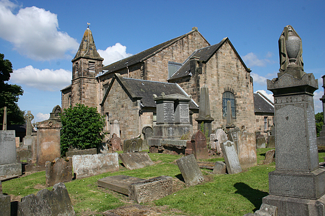
New Monkland Parish Kirk
Introduction
The photograph on this page of New Monkland Parish Kirk by Anne Burgess as part of the Geograph project.
The Geograph project started in 2005 with the aim of publishing, organising and preserving representative images for every square kilometre of Great Britain, Ireland and the Isle of Man.
There are currently over 7.5m images from over 14,400 individuals and you can help contribute to the project by visiting https://www.geograph.org.uk

Image: © Anne Burgess Taken: 10 Jul 2014
The kirk and kirkyard are at Glenmavis, a mile or so from Airdrie. Originally built in about 1650, a single-storey building with a short steeple, the kirk was heightened in 1777, making the old steeple look a bit odd. Or was it? The Royal Commission on the Ancient and Historic Monuments of Scotland questions the alleged antiquity of the steeple, saying that its construction is similar to the rest of the 1777 stonework. Its stone used to be blackened by pollution from local heavy industry, earning it the nickname, 'The Auld Grey Kirk on the hill' but with the improvement in air quality the sandstone is reverting to a more natural colour.

