IMAGES TAKEN NEAR TO
Whitelaw Avenue, COATBRIDGE, ML5 2PX
Introduction
This page details the photographs taken nearby to Whitelaw Avenue, ML5 2PX by members of the Geograph project.
The Geograph project started in 2005 with the aim of publishing, organising and preserving representative images for every square kilometre of Great Britain, Ireland and the Isle of Man.

There are currently over 7.5m images from over14,400 individuals and you can help contribute to the project by visiting https://www.geograph.org.uk
Image Map (Loading...)


Getting Data...Please wait
Leaflet Map data © OpenStreetMap
Images are licensed for reuse under creativecommons.org/licenses/by-sa/2.0
Notes
- Clicking on the map will re-center to the selected point.
- The higher the marker number, the further away the image location is from the centre of the postcode.
Image Listing (7 Images Found)
Images are licensed for reuse under creativecommons.org/licenses/by-sa/2.0
Image
Details
Distance
2
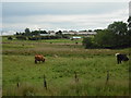
View towards Glenboig
Highland cattle in foreground.
Image: © Jim Smillie
Taken: 6 Jul 2009
0.12 miles
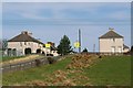
3
Muirdyke Road
Looking east along Muirdyke Road.
Glenmavis Gas Storage Facility visible in the distance.
Image: © Texas Radio and The Big Beat
Taken: 10 Apr 2010
0.18 miles
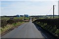
4
Heading towards Glenboig
On Gartliston Road.
Campsies in distance.
Image: © Jim Smillie
Taken: 1 Apr 2022
0.19 miles
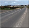
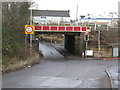
5
Railway bridge
Carrying Cumbernauld to Glasgow and Motherwell line over Coatbridge Road.
Image: © Jim Smillie
Taken: 6 Jul 2009
0.25 miles
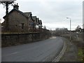
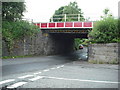
6
Railway Bridge in Glenboig
The bridge carries the Cumbernauld to Motherwell railway line between Greenfaulds and Coatbridge Central railway stations. It also carries the Cumbernauld line between Greenfaulds and Gartcosh railway stations.
The road under the bridge is the B804 leading to Gartcosh.
Image: © G Laird
Taken: 1 Jan 2014
0.25 miles