IMAGES TAKEN NEAR TO
Shepford Place, COATBRIDGE, ML5 1RS

Introduction

This page details the photographs taken nearby to Shepford Place, ML5 1RS by members of the Geograph project.

The Geograph project started in 2005 with the aim of publishing, organising and preserving representative images for every square kilometre of Great Britain, Ireland and the Isle of Man.

There are currently over 7.5m images from over14,400 individuals and you can help contribute to the project by visiting https://www.geograph.org.uk

Image Map


Images are licensed for reuse under creativecommons.org/licenses/by-sa/2.0
Notes
  • Clicking on the map will re-center to the selected point.
  • The higher the marker number, the further away the image location is from the centre of the postcode.

Image Listing (10 Images Found)

Images are licensed for reuse under creativecommons.org/licenses/by-sa/2.0
Image
Details
Distance
1
Drumpellier houses
Private housing estate built in the 1950s beside Drumpellier golf course.
Image: © James Allan Taken: 20 Sep 2009
0.09 miles
2
Monkland Canal, Drumpellier Country Park
Image: © Chris Upson Taken: 24 Feb 2006
0.11 miles
3
Swans on the Monkland Canal
Near Drumpellier Park.
Image: © wrobison Taken: 10 Sep 2022
0.16 miles
4
Housing, Drumpellier Avenue
Image: © Jonathan Thacker Taken: 20 Feb 2020
0.16 miles
5
Next stop Blairhill
Glasgow-Edinburgh via Airdrie & Bathgate
Image: © Jim Smillie Taken: 23 Apr 2021
0.16 miles
6
Drumpellier country park
With the Airdrie-Glasgow railway line in the background.
Image: © Nigel Thompson Taken: 5 Jul 2014
0.18 miles
7
Coatbridge from the air
The northwest corner of the town, with the Freightliner container terminal at the top of the photo and the joint St Ambrose High School and Drumpark School construction site at the bottom.
Image: © Thomas Nugent Taken: 28 Jun 2011
0.18 miles
8
View over Coatbridge from Drumpellier Avenue
Image: © Jonathan Thacker Taken: 20 Feb 2020
0.19 miles
9
Three Coatbridge schools from the air
Buchanan High School (former Drumpark Secondary) and St Ambrose High School are in the foreground. St Bartholomew's Primary School is at the top of the photo. See also Image
Image: © Thomas Nugent Taken: 9 Feb 2018
0.21 miles
10
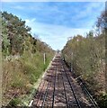
Bridge over the North Clyde Railway Line
In Drumpellior Country Park.
Image: © G Laird Taken: 12 Jul 2012
0.22 miles