Coatbridge from the air
Introduction
The photograph on this page of Coatbridge from the air by Thomas Nugent as part of the Geograph project.
The Geograph project started in 2005 with the aim of publishing, organising and preserving representative images for every square kilometre of Great Britain, Ireland and the Isle of Man.

There are currently over 7.5m images from over 14,400 individuals and you can help contribute to the project by visiting https://www.geograph.org.uk
Coatbridge from the air
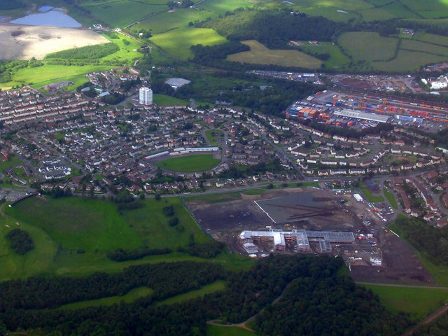
Image: © Thomas Nugent Taken: 28 Jun 2011
The northwest corner of the town, with the Freightliner container terminal at the top of the photo and the joint St Ambrose High School and Drumpark School construction site at the bottom.
Images are licensed for reuse under creativecommons.org/licenses/by-sa/2.0
Image Location
Latitude
55.865492
Longitude
-4.054907