IMAGES TAKEN NEAR TO
Capercaillie Crescent, HAMILTON, ML3 7GG
Introduction
This page details the photographs taken nearby to Capercaillie Crescent, ML3 7GG by members of the Geograph project.
The Geograph project started in 2005 with the aim of publishing, organising and preserving representative images for every square kilometre of Great Britain, Ireland and the Isle of Man.

There are currently over 7.5m images from over14,400 individuals and you can help contribute to the project by visiting https://www.geograph.org.uk
Image Map
Images are licensed for reuse under creativecommons.org/licenses/by-sa/2.0
Notes
- Clicking on the map will re-center to the selected point.
- The higher the marker number, the further away the image location is from the centre of the postcode.
Image Listing (9 Images Found)
Images are licensed for reuse under creativecommons.org/licenses/by-sa/2.0
Image
Details
Distance
1
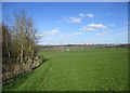
Edge of plantation near Allanton
The woodland on the left is on the site of the former Allanton Colliery.
High-rise flats in Motherwell are visible in the distance, beyond the M74, where a couple of lorries can be seen travelling southbound.
Image: © Alan O'Dowd
Taken: 7 Apr 2020
0.18 miles
2
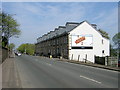
Allanton Terrace on Larkhall to Hamilton Road
Image: © Iain Thompson
Taken: 6 May 2006
0.19 miles
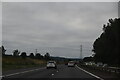
5
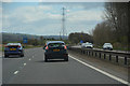
South Lanarkshire : The M74 Motorway
Looking along the M74 motorway.
Image: © Lewis Clarke
Taken: 25 Apr 2016
0.20 miles
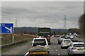
6
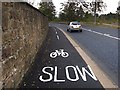
New Cycle Track from Larkhall to Ferniegair
A re-surfaced and widened pavement
Image: © wrobison
Taken: 4 Oct 2012
0.22 miles
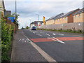
7
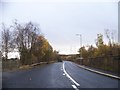
A72 Hamilton to Larkhall Road
With access to the railway line on the left
Image: © Elliott Simpson
Taken: 12 Nov 2012
0.23 miles
8
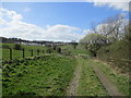
Track near Allanton
Looking towards Allanton, where there has recently been quite a bit of new housing development, as seen on the left of the photo.
Image: © Alan O'Dowd
Taken: 7 Apr 2020
0.24 miles
9
National Cycle Route 74 in Ferniegair
At an uncontrolled crossing point on Carlisle Road where the route continues on the other pavement.
Image: © wrobison
Taken: 14 Sep 2020
0.24 miles