IMAGES TAKEN NEAR TO
Leonard Grove, MOTHERWELL, ML1 5JJ

Introduction

This page details the photographs taken nearby to Leonard Grove, ML1 5JJ by members of the Geograph project.

The Geograph project started in 2005 with the aim of publishing, organising and preserving representative images for every square kilometre of Great Britain, Ireland and the Isle of Man.

There are currently over 7.5m images from over14,400 individuals and you can help contribute to the project by visiting https://www.geograph.org.uk

Image Map


Images are licensed for reuse under creativecommons.org/licenses/by-sa/2.0
Notes
  • Clicking on the map will re-center to the selected point.
  • The higher the marker number, the further away the image location is from the centre of the postcode.

Image Listing (12 Images Found)

Images are licensed for reuse under creativecommons.org/licenses/by-sa/2.0
Image
Details
Distance
1
Houses at the entrance to Dalziel Park
The houses are part of the luxury housing development built on part of the former Cleland Estate. The estate was owned by John Colville, 1st Baron Clydesmuir until 1947 when it was sold to the Dalziel High School Memorial Trust. The Trust had decided that the school’s memorial to Former Pupils who had died during the two World Wars should take the form of playing fields. In 1990, to meet increasing maintenance costs, the estate was changed to form Dalziel Park which consists of improved sports facilities with a clubhouse, a housing development and a hotel with a golf course and a conference centre.
Image: © wrobison Taken: 3 Mar 2021
0.05 miles
2
Coach hire company on Chapelknowe Road
Image: © JThomas Taken: 17 Sep 2021
0.06 miles
3
Chapelknowe Road (B7029)
Towards Cleland.
Image: © JThomas Taken: 17 Sep 2021
0.08 miles
4
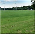
View from Hagen drive
Across these well maintained sports facilities
Image: © Jim Smillie Taken: 8 Sep 2021
0.08 miles
5
Jones Wynd
Image: © Alex McGregor Taken: 18 Nov 2014
0.09 miles
6
B7029 where it passes Dalziel Park
Looking west along the B7029, the Cleland to Carfin Road in the direction of Carfin, which can be seen in the distance. The entrance to Dalziel Park is on the left.
Image: © G Laird Taken: 12 Apr 2009
0.11 miles
7
Cotton Vale
Image: © Alex McGregor Taken: 18 Nov 2014
0.13 miles
8
New house, Braid Avenue
Image: © Alex McGregor Taken: 18 Nov 2014
0.16 miles
9
New house, Braid Avenue
Image: © Alex McGregor Taken: 18 Nov 2014
0.17 miles
10
Dumb dumpers yet again
The map says "Tips disused", sadly this is not strictly true. The whole of Lanarkshire, save the hills is one big tip thanks to these lowlives. Some roads have CCTV, but the vermin always find somewhere quiet. Much of the waste is from businesses.
Image: © Richard Webb Taken: 24 Oct 2011
0.18 miles