IMAGES TAKEN NEAR TO
Lower Gravenhurst, BEDFORD, MK45 4HJ
Introduction
This page details the photographs taken nearby to Lower Gravenhurst, MK45 4HJ by members of the Geograph project.
The Geograph project started in 2005 with the aim of publishing, organising and preserving representative images for every square kilometre of Great Britain, Ireland and the Isle of Man.

There are currently over 7.5m images from over14,400 individuals and you can help contribute to the project by visiting https://www.geograph.org.uk
Image Map
Images are licensed for reuse under creativecommons.org/licenses/by-sa/2.0
Notes
- Clicking on the map will re-center to the selected point.
- The higher the marker number, the further away the image location is from the centre of the postcode.
Image Listing (13 Images Found)
Images are licensed for reuse under creativecommons.org/licenses/by-sa/2.0
Image
Details
Distance
2
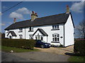
Lower Gravenhurst
Heading north west, Ion Bridge.
Image: © JThomas
Taken: 25 Mar 2016
0.04 miles
4
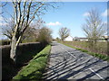
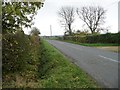
The road to Lower Gravenhurst
Looking north-west past an entrance to Ion Bridge Poultry Farm. Signposted as a scenic route.
Image: © Christine Johnstone
Taken: 30 Oct 2014
0.07 miles
5
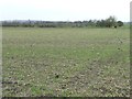
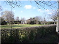
Greening field south-east of College Farm
The hedge growing along a drain.
Image: © Christine Johnstone
Taken: 30 Oct 2014
0.09 miles
6
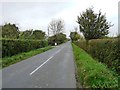
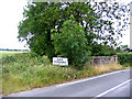
The road to Hanscombe End
Looking south-east at the entrance to a house at Ion Bridge Poultry Farm.
Image: © Christine Johnstone
Taken: 30 Oct 2014
0.11 miles
7
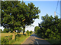
Country road, Lower Gravenhurst, Beds
Between College Farm and Ion Bridge Farm, in the NE corner of the square.
Image: © Rodney Burton
Taken: 28 Jun 2006
0.11 miles
8
Ion Bridge, Lower Gravenhurst, Beds
Not named as such on maps, but near Ion Bridge Farm; the stream the concrete bridge crosses joins the River Ivel at Shefford.
Image: © Rodney Burton
Taken: 27 Jun 2006
0.13 miles
9
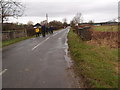
Ion Bridge
An LDWA walking group taking to the roads, fed up with endless mud tracks and wet holes by stiles. Image
Image: © Michael Trolove
Taken: 17 Mar 2013
0.13 miles
10
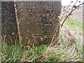
Benchmark on a bridge
An OS cut mark on Ion Bridge.
Image: © Michael Trolove
Taken: 17 Mar 2013
0.13 miles