IMAGES TAKEN NEAR TO
Lemmon Walk, MILTON KEYNES, MK4 4JB
Introduction
This page details the photographs taken nearby to Lemmon Walk, MK4 4JB by members of the Geograph project.
The Geograph project started in 2005 with the aim of publishing, organising and preserving representative images for every square kilometre of Great Britain, Ireland and the Isle of Man.

There are currently over 7.5m images from over14,400 individuals and you can help contribute to the project by visiting https://www.geograph.org.uk
Image Map (Loading...)


Getting Data...Please wait
Leaflet Map data © OpenStreetMap
Images are licensed for reuse under creativecommons.org/licenses/by-sa/2.0
Notes
- Clicking on the map will re-center to the selected point.
- The higher the marker number, the further away the image location is from the centre of the postcode.
Image Listing (14 Images Found)
Images are licensed for reuse under creativecommons.org/licenses/by-sa/2.0
Image
Details
Distance
1
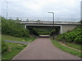
Path around the Whitney Roundabout
Path around the Whitney Roundabout heading under Snelshall Street
Image: © Shaun Ferguson
Taken: 2 May 2014
0.08 miles

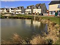
6
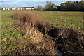
Stream through Oxley Mead
Oxley Mead is a SSSI, floodplain meadow, mostly surrounded by the Oxley Park grid square of Milton Keynes
Image: © Philip Jeffrey
Taken: 18 Jan 2015
0.18 miles
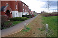
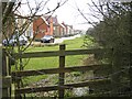
7
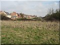
Oxley Park taking shape
Still working on houses here despite the downturn albeit slowly.
Image: © Malcolm Campbell
Taken: 5 Mar 2009
0.19 miles
8
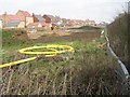
Boundary marker
When wandering around the area, I noticed that the development areas have been marked out with aluminium edging.
Image: © Malcolm Campbell
Taken: 5 Mar 2009
0.19 miles
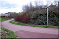
9
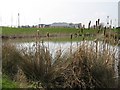
No need to rush
Tranquil pond near the Tesco Express at Kingsmead development, shows Oxley Park Primary School in the background.
Image: © Malcolm Campbell
Taken: 5 Mar 2009
0.19 miles
10
Sheridan Grove
New development formerly part of Shenley Common Farm South, the map shows the area as Whitney and the V1/H6 roundabout is named Whitney Roundabout. I mentioned this to a local resident I met during this walk and he intimated to me that the area was now only referred to by the name Oxley Park.
Image: © Malcolm Campbell
Taken: 5 Mar 2009
0.23 miles