IMAGES TAKEN NEAR TO
Ibbett Close, BEDFORD, MK43 9BT
Introduction
This page details the photographs taken nearby to Ibbett Close, MK43 9BT by members of the Geograph project.
The Geograph project started in 2005 with the aim of publishing, organising and preserving representative images for every square kilometre of Great Britain, Ireland and the Isle of Man.

There are currently over 7.5m images from over14,400 individuals and you can help contribute to the project by visiting https://www.geograph.org.uk
Image Map
Images are licensed for reuse under creativecommons.org/licenses/by-sa/2.0
Notes
- Clicking on the map will re-center to the selected point.
- The higher the marker number, the further away the image location is from the centre of the postcode.
Image Listing (12 Images Found)
Images are licensed for reuse under creativecommons.org/licenses/by-sa/2.0
Image
Details
Distance
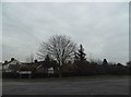
4
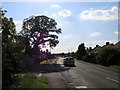
Gibraltar Corner, near Wootton
Gibraltar Corner, near Wootton, is a residential area close to Bedford.
Image: © Malc McDonald
Taken: 20 Oct 2012
0.16 miles
8
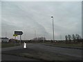
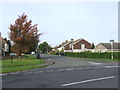
Ridge Road at the junction of The Branston Way
The houses have gone up in the last couple of years, encroaching into the green belt.
Image: © David Howard
Taken: 12 Mar 2017
0.19 miles
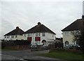
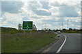
9
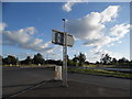
Roundabout on The Branston Way, Kempston
Image: © David Howard
Taken: 11 Jun 2017
0.20 miles
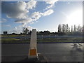
10
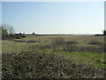
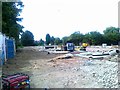
Farmland near Green End
Unproductive-looking land, maybe ear-marked for development in Kempston Rural parish.
Image: © Burgess Von Thunen
Taken: 28 Mar 2012
0.20 miles