1
Car Park
This is the car park to Aspects leisure Centre. Home to redundant leisure outlets, a cinema and a gym. The people of Bedford were given all this in place of a very fine open air swimming pool.
Image: © Dennis simpson
Taken: 13 Feb 2008
0.02 miles
2
Bedford fire station
Bedford fire station, Barkers Lane, Bedford, Bedfordshire
Image: © Kevin Hale
Taken: 7 Oct 2007
0.08 miles
3
Bedford's river Great Ouse
From the Bedford-Sandy cycleway (previously the Bedford-Cambridge railway line)
Image: © Oliver White
Taken: 2 Dec 2006
0.10 miles
4
Footbridge over the River Great Ouse
Image: © Tim Glover
Taken: 11 Jul 2004
0.12 miles
5
Bedford International Athletics Stadium
Now the home to major athletic events. Earlier in its career it only seemed to be used by the local schools!
Image: © Dennis simpson
Taken: 13 Feb 2008
0.14 miles
6
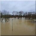
Up periscope?
Submerged path, with light, by one stream of the River Great Ouse and adjacent Boating Lake, as seen from Longholme Bridge, after extensive flooding on Boxing Day.
Image: © Duncan Richardson
Taken: 26 Dec 2020
0.15 miles
7
Old railway bridge over the Great Ouse at Bedford
This former railway bridge now carries a cyclepath over the Great Ouse. This cycle route connects Bedford to Sandy and is part of NCN51.
Image: © Robert Kerr
Taken: 17 Sep 2011
0.15 miles
8
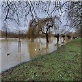
The Great Ouse in Flood - Boxing Day 2020
Looking west, upstream, from near the footbridge at the junction of Longholme Way and the Embankment. Quite a lot of people out looking, and hoping it won't go much higher.
Image: © Duncan Richardson
Taken: 26 Dec 2020
0.15 miles
9
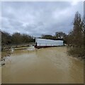
The Great Ouse in flood
The King's Bridge under repair https://www.bedfordindependent.co.uk/kings-bridge-to-close-for-refurbishment/ overtaken by events. Anticipated to take 6 months, I expect it will now take a lot longer, after being inundated by the Boxing Day flood. At first I thought it was a curtain trailer that had relied on GPS.
Image: © Duncxan Richardson
Taken: 26 Dec 2020
0.16 miles
10
The River Great Ouse
A view downstream from the Butterfly Bridge.
Image: © M J Richardson
Taken: 9 Sep 2007
0.16 miles


