IMAGES TAKEN NEAR TO
Rhineland Way, BEDFORD, MK41 7YP
Introduction
This page details the photographs taken nearby to Rhineland Way, MK41 7YP by members of the Geograph project.
The Geograph project started in 2005 with the aim of publishing, organising and preserving representative images for every square kilometre of Great Britain, Ireland and the Isle of Man.

There are currently over 7.5m images from over14,400 individuals and you can help contribute to the project by visiting https://www.geograph.org.uk
Image Map
Images are licensed for reuse under creativecommons.org/licenses/by-sa/2.0
Notes
- Clicking on the map will re-center to the selected point.
- The higher the marker number, the further away the image location is from the centre of the postcode.
Image Listing (28 Images Found)
Images are licensed for reuse under creativecommons.org/licenses/by-sa/2.0
Image
Details
Distance
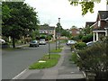
1
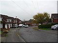
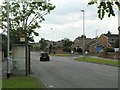
Rhineland Way
1980s houses in Brickhill.
Image: © Burgess Von Thunen
Taken: 9 Nov 2011
0.02 miles
2
Brickhill
Underpass under Tyne Crescent.
Image: © Burgess Von Thunen
Taken: 9 Nov 2011
0.05 miles
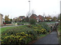
3
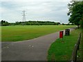
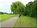
Mowsbury Park, Bedford
From the pedestrian entrance off Kimbolton Road. Putnoe Wood is at the far side.
Image: © Rich Tea
Taken: 19 Jun 2009
0.07 miles
4
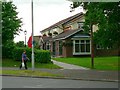
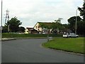
The Pheasant, Kimbolton Road
By the roundabout at the junction of Kimbolton Road and Avon Drive.
Image: © Rich Tea
Taken: 19 Jun 2009
0.07 miles
5
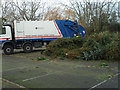
Christmas trees for the chop
Post Christmas recycling of trees dumped at a recycling point at Mowsbury Park.
Image: © Michael Trolove
Taken: 12 Jan 2012
0.08 miles
6
Avon Drive and the junction of Tyne Crescent, Bedford
Avon Drive forms a large crescent through the Brickhill estate, from its junction with Kimbolton Road and Rowallan Drive at the south end, the north end here. Behind the camera, is the roundabout at the junction of Avon Drive, Kimbolton Road and Wentworth Drive.
Image: © Rich Tea
Taken: 19 Jun 2009
0.10 miles
7
Roundabout, Kimbolton Road and Avon Drive, Bedford
With The Pheasant pub in the background.
Image: © Rich Tea
Taken: 19 Jun 2009
0.11 miles
9
Lambourn Way, Brickhill, Bedford
Leading to Bourneside, with Image] just past the cars on the right.
Image: © Rich Tea
Taken: 19 Jun 2009
0.13 miles
10
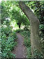
In the spinney by Mowsbury Park
When I played in the spinney as a child, in the 1950's and early 60's, there were fields either side of it. Parkstone Close, on its south side, was built in the late 1960's and Mowsbury Park was laid out in the 1970's.
Image: © Rich Tea
Taken: 19 Jun 2009
0.13 miles