IMAGES TAKEN NEAR TO
Severn Way, BEDFORD, MK41 7BY
Introduction
This page details the photographs taken nearby to Severn Way, MK41 7BY by members of the Geograph project.
The Geograph project started in 2005 with the aim of publishing, organising and preserving representative images for every square kilometre of Great Britain, Ireland and the Isle of Man.

There are currently over 7.5m images from over14,400 individuals and you can help contribute to the project by visiting https://www.geograph.org.uk
Image Map
Images are licensed for reuse under creativecommons.org/licenses/by-sa/2.0
Notes
- Clicking on the map will re-center to the selected point.
- The higher the marker number, the further away the image location is from the centre of the postcode.
Image Listing (15 Images Found)
Images are licensed for reuse under creativecommons.org/licenses/by-sa/2.0
Image
Details
Distance
1
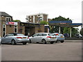
'The Tiger Moth'
A local pub at Brickhill shopping centre.
Image: © M J Richardson
Taken: 21 Sep 2017
0.02 miles
2
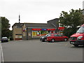
Shops at Brickhill
A small local shopping centre on the outskirts of Bedford.
Image: © M J Richardson
Taken: 21 Sep 2017
0.03 miles
3
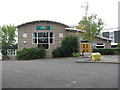
Brickhill Community Centre
Adjacent to a small group of local shops on Avon Drive.
Image: © M J Richardson
Taken: 21 Sep 2017
0.03 miles
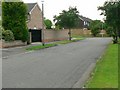
4
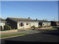
Torridge Rise
1970s bungalows and electricity wires in Brickhill.
Image: © Burgess Von Thunen
Taken: 21 Feb 2012
0.13 miles
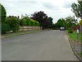
5
Tamar Road, Brickhill, Bedford
Looking towards Waveney Ave.
These roads were laid out in the late 1950's
Image: © Rich Tea
Taken: 19 Jun 2009
0.15 miles
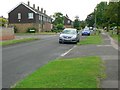
6
Rother Close, Brickhill, Bedford
From Tamar Road.
Image: © Rich Tea
Taken: 19 Jun 2009
0.15 miles
7
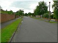
Tamar Road, Brickhill, Bedford
Looking from the junction with Kimbolton Road.
The road was built in the late 1950's, as I was growing up in a house in Kimbolton Road. I remember watching from my bedroom window, and seeing the hedge sway as a bulldozer bumped it. It was clearing topsoil, and the hedge was only removed when the road was part built.
Image: © Rich Tea
Taken: 19 Jun 2009
0.20 miles
8
Bourneside, Brickhill, Bedford
Looking towards the junction with Waveney Ave.
Image: © Rich Tea
Taken: 19 Jun 2009
0.22 miles
9
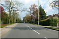
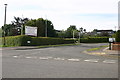
B660 Kimbolton Road, Brickhill, Bedford
Towards Kimbolton.
Image: © Robin Webster
Taken: 2 May 2021
0.22 miles
10
St Mark's Church community centre
St Mark's Church community centre on Calder rise
Image: © Shaun Ferguson
Taken: 12 Jul 2007
0.22 miles