IMAGES TAKEN NEAR TO
Welsh Lane, BUCKINGHAM, MK18 5EA
Introduction
This page details the photographs taken nearby to Welsh Lane, MK18 5EA by members of the Geograph project.
The Geograph project started in 2005 with the aim of publishing, organising and preserving representative images for every square kilometre of Great Britain, Ireland and the Isle of Man.

There are currently over 7.5m images from over14,400 individuals and you can help contribute to the project by visiting https://www.geograph.org.uk
Image Map
Images are licensed for reuse under creativecommons.org/licenses/by-sa/2.0
Notes
- Clicking on the map will re-center to the selected point.
- The higher the marker number, the further away the image location is from the centre of the postcode.
Image Listing (2 Images Found)
Images are licensed for reuse under creativecommons.org/licenses/by-sa/2.0
Image
Details
Distance
1
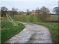
Boycott Manor Farmhouse
Taken from the gateway at the beginning of its drive from off Welsh Lane. This photo gives a closer view of the farmhouse whereas Image] is a general view of the farm.
Image: © Rob Farrow
Taken: 23 Feb 2007
0.01 miles
2
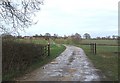
Boycott Manor Farm
A general view of Boycott Manor Farm from where its drive leaves Welsh Lane. For a closer view of the farmhouse see Image]
Image: © Rob Farrow
Taken: 23 Feb 2007
0.01 miles