IMAGES TAKEN NEAR TO
Church Road, MILTON KEYNES, MK17 9BP
Introduction
This page details the photographs taken nearby to Church Road, MK17 9BP by members of the Geograph project.
The Geograph project started in 2005 with the aim of publishing, organising and preserving representative images for every square kilometre of Great Britain, Ireland and the Isle of Man.

There are currently over 7.5m images from over14,400 individuals and you can help contribute to the project by visiting https://www.geograph.org.uk
Image Map
Images are licensed for reuse under creativecommons.org/licenses/by-sa/2.0
Notes
- Clicking on the map will re-center to the selected point.
- The higher the marker number, the further away the image location is from the centre of the postcode.
Image Listing (29 Images Found)
Images are licensed for reuse under creativecommons.org/licenses/by-sa/2.0
Image
Details
Distance
1
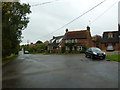
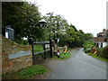
Houses opposite St Luke's Church, Stoke Hammond
Image: © Basher Eyre
Taken: 6 Sep 2011
0.02 miles
2
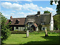
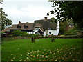
Orchard Cottage, Stoke Hammond
Opposite the church.
Image: © Robin Webster
Taken: 25 May 2014
0.03 miles
3
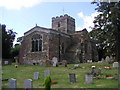
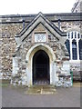
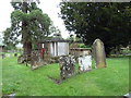
St Luke's Church, Stoke Hammond
The main church in Stoke Hammond, the rectory on adjoining grounds is now in private ownership. There's also a public footpath that cuts through the churchyard on the way to Milton Keynes.
Image: © Mr Biz
Taken: 30 Jul 2006
0.04 miles
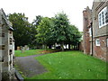
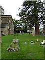
8
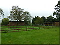
Hay barns seen from St Luke's Churchyard
Image: © Basher Eyre
Taken: 6 Sep 2011
0.07 miles