IMAGES TAKEN NEAR TO
Lower Road, SITTINGBOURNE, ME9 9EQ
Introduction
This page details the photographs taken nearby to Lower Road, ME9 9EQ by members of the Geograph project.
The Geograph project started in 2005 with the aim of publishing, organising and preserving representative images for every square kilometre of Great Britain, Ireland and the Isle of Man.

There are currently over 7.5m images from over14,400 individuals and you can help contribute to the project by visiting https://www.geograph.org.uk
Image Map
Images are licensed for reuse under creativecommons.org/licenses/by-sa/2.0
Notes
- Clicking on the map will re-center to the selected point.
- The higher the marker number, the further away the image location is from the centre of the postcode.
Image Listing (65 Images Found)
Images are licensed for reuse under creativecommons.org/licenses/by-sa/2.0
Image
Details
Distance
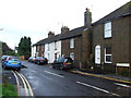
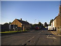
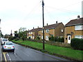
1
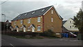
Selby Court, Teynham
Housing in the village of Teynham, Kent.
Image: © Malc McDonald
Taken: 26 Oct 2013
0.03 miles
6
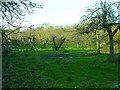
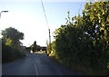
Orchard between the railway and the road
A narrow triangular strip of apple orchard, opposite the Image The railway embankment blocks the view through the trees.
Image: © Penny Mayes
Taken: 1 Jan 2007
0.07 miles
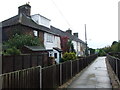
9
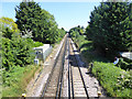
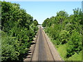
Railway east of Teynham station
Next stop Faversham.
Image: © Robin Webster
Taken: 14 Jun 2017
0.09 miles