IMAGES TAKEN NEAR TO
Keycol Hill, SITTINGBOURNE, ME9 8LZ
Introduction
This page details the photographs taken nearby to Keycol Hill, ME9 8LZ by members of the Geograph project.
The Geograph project started in 2005 with the aim of publishing, organising and preserving representative images for every square kilometre of Great Britain, Ireland and the Isle of Man.

There are currently over 7.5m images from over14,400 individuals and you can help contribute to the project by visiting https://www.geograph.org.uk
Image Map
Images are licensed for reuse under creativecommons.org/licenses/by-sa/2.0
Notes
- Clicking on the map will re-center to the selected point.
- The higher the marker number, the further away the image location is from the centre of the postcode.
Image Listing (44 Images Found)
Images are licensed for reuse under creativecommons.org/licenses/by-sa/2.0
Image
Details
Distance
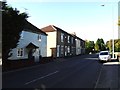
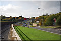
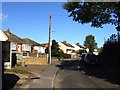
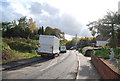
7
Old Maidstone Road, formerly Chestnut Street
Image: © Chris Whippet
Taken: 3 Nov 2013
0.14 miles
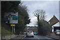
9
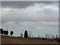
Rooks, maize stubble, and a winter sky
There seem to be huge numbers of rooks in this part of Kent this year. These were feeding in a field of stubble where a maize crop has been cut, but the field left unploughed. There are still many birds on the ground between me and the middle tree.
Image: © Richard Dorrell
Taken: 13 Jan 2008
0.15 miles