IMAGES TAKEN NEAR TO
Vigo Lane, SITTINGBOURNE, ME9 8LE
Introduction
This page details the photographs taken nearby to Vigo Lane, ME9 8LE by members of the Geograph project.
The Geograph project started in 2005 with the aim of publishing, organising and preserving representative images for every square kilometre of Great Britain, Ireland and the Isle of Man.

There are currently over 7.5m images from over14,400 individuals and you can help contribute to the project by visiting https://www.geograph.org.uk
Image Map
Images are licensed for reuse under creativecommons.org/licenses/by-sa/2.0
Notes
- Clicking on the map will re-center to the selected point.
- The higher the marker number, the further away the image location is from the centre of the postcode.
Image Listing (15 Images Found)
Images are licensed for reuse under creativecommons.org/licenses/by-sa/2.0
Image
Details
Distance
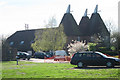
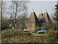
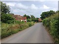
3
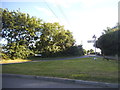
Hengist Field and barns at Sutton Baron
From the track which goes under the motorway http://www.geograph.org.uk/photo/366389 in Image . The business units at Hengist Field (left of centre) have been designed to look like oast houses although I remember this as a chicken farm.
Image: © Penny Mayes
Taken: 12 Mar 2007
0.02 miles
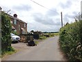
4
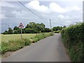
Pond Farm Road at the junction of Sutton Baron Road
Image: © David Howard
Taken: 17 Jul 2016
0.05 miles
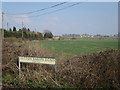
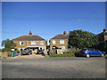
5
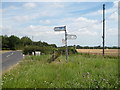
Road junction as Pond Farm Road turns the corner to Oad Street
Image: © pam fray
Taken: 30 Jul 2008
0.05 miles