
IMAGES TAKEN NEAR TO
Chestnut Wood Lane, SITTINGBOURNE, ME9 8DH
Introduction
This page details the photographs taken nearby to Chestnut Wood Lane, ME9 8DH by members of the Geograph project.
The Geograph project started in 2005 with the aim of publishing, organising and preserving representative images for every square kilometre of Great Britain, Ireland and the Isle of Man.

There are currently over 7.5m images from over14,400 individuals and you can help contribute to the project by visiting https://www.geograph.org.uk
Image Map
Images are licensed for reuse under creativecommons.org/licenses/by-sa/2.0
Notes
- Clicking on the map will re-center to the selected point.
- The higher the marker number, the further away the image location is from the centre of the postcode.
Image Listing (46 Images Found)
Images are licensed for reuse under creativecommons.org/licenses/by-sa/2.0
Image
Details
Distance
1
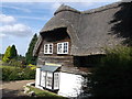
Thatched Cottage, Chestnut Street
This pretty Grade II cottage is on Chestnut Wood Lane.
See http://www.britishlistedbuildings.co.uk/en-176051-the-thatched-cottage-borden-kent for more details.
Image: © David Anstiss
Taken: 6 Sep 2012
0.05 miles
2
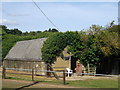
Nissen Hut, Chestnut Street
This former world war II bomb shelter has a new life as a horse stables.
Image: © David Anstiss
Taken: 6 Sep 2012
0.05 miles
3
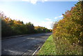
Chestnut street
The route of the old A249.
Image: © N Chadwick
Taken: 30 Oct 2010
0.08 miles
4
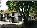
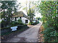
Chestnut Street Farmhouse
Grade II listed house on Chestnut Wood Lane. Also a Wealden hall house.
See http://www.britishlistedbuildings.co.uk/en-176050-chestnut-street-farmhouse-borden-kent for more details.
Image: © David Anstiss
Taken: 6 Sep 2012
0.08 miles
6
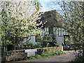
Chestnut Street Farmhouse, Chestnut Street
Grade II listed Wealden hall house.
Image: © Oast House Archive
Taken: 6 Apr 2011
0.09 miles
7
Footpath signs near Chestnut Street
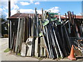
This was in a depot next to Chestnut Wood. Some of these looked new and some of the old stone signs were here too. The walk we followed around the Chestnut Street and Borden area referred to stone footpath signs, most of which had gone so perhaps this is where they ended up. Strangely enough the only stone sign we saw was only about 20 yards away at the entrance to Chestnut Wood - see http://www.geograph.org.uk/photo/4912149
Image: © Marathon
Taken: 17 Apr 2016
0.09 miles
9
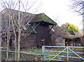
Barn at Chestnut Street Farm
Looking pretty much disused, this is a substantial wooden barn with asbestos sheeting roof.
Image: © Richard Dorrell
Taken: 12 Jan 2008
0.09 miles
10
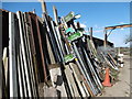
Footpath signs near Chestnut Street
Some of these looked new and some of the old stone signs were here too. The walk we followed around the Chestnut Street and Borden area referred to stone footpath signs, most of which had gone so perhaps this is where they ended up. Strangely enough the only stone sign we saw was only about 20 yards away at the entrance to Chestnut Wood - see http://www.geograph.org.uk/photo/4912149
Image: © Marathon
Taken: 17 Apr 2016
0.09 miles