IMAGES TAKEN NEAR TO
Warren Lane, SITTINGBOURNE, ME9 7XL
Introduction
This page details the photographs taken nearby to Warren Lane, ME9 7XL by members of the Geograph project.
The Geograph project started in 2005 with the aim of publishing, organising and preserving representative images for every square kilometre of Great Britain, Ireland and the Isle of Man.

There are currently over 7.5m images from over14,400 individuals and you can help contribute to the project by visiting https://www.geograph.org.uk
Image Map
Images are licensed for reuse under creativecommons.org/licenses/by-sa/2.0
Notes
- Clicking on the map will re-center to the selected point.
- The higher the marker number, the further away the image location is from the centre of the postcode.
Image Listing (11 Images Found)
Images are licensed for reuse under creativecommons.org/licenses/by-sa/2.0
Image
Details
Distance
3
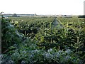
Christmas trees
Acres of them, west of Warren Lane.
Image: © Penny Mayes
Taken: 19 Nov 2005
0.10 miles
5
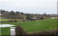
Sweepstakes Farm
Seen from a passing coach on the M2 motorway.
Image: © Martin Addison
Taken: 21 Mar 2015
0.15 miles
6
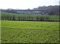
M2 viaduct over Mount Lane, Hartlip
The motorway cuts through Queendown Warren http://www.geograph.org.uk/photo/81576 on the right.
Image: © Penny Mayes
Taken: 14 Feb 2006
0.17 miles
7
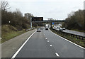
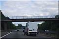
M2 near Hartlip
Descending to pass under Warren Lane.
Image: © Martin Addison
Taken: 21 Mar 2015
0.20 miles
9

Yew tree Cottage, The Street, Hartlip
A 17th century, Grade II listed building. http://www.britishlistedbuildings.co.uk/en-176143-yew-tree-cottage-hartlip
Image: © N Chadwick
Taken: 30 Oct 2010
0.24 miles