IMAGES TAKEN NEAR TO
Iwade Road, SITTINGBOURNE, ME9 7HY
Introduction
This page details the photographs taken nearby to Iwade Road, ME9 7HY by members of the Geograph project.
The Geograph project started in 2005 with the aim of publishing, organising and preserving representative images for every square kilometre of Great Britain, Ireland and the Isle of Man.

There are currently over 7.5m images from over14,400 individuals and you can help contribute to the project by visiting https://www.geograph.org.uk
Image Map
Images are licensed for reuse under creativecommons.org/licenses/by-sa/2.0
Notes
- Clicking on the map will re-center to the selected point.
- The higher the marker number, the further away the image location is from the centre of the postcode.
Image Listing (10 Images Found)
Images are licensed for reuse under creativecommons.org/licenses/by-sa/2.0
Image
Details
Distance
1
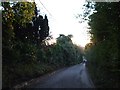
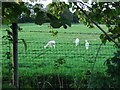
Iwade Road, near Newington
Also known as High Oak Hill.
Image: © Chris Whippet
Taken: 11 Nov 2013
0.08 miles
2
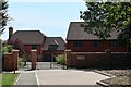
New housing development at High Oak Hill Farm
Image: © Oast House Archive
Taken: 18 Jul 2020
0.09 miles
4
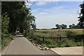
Iwade Road, near Newington
Also known as High Oak Hill.
Image: © Chris Whippet
Taken: 11 Nov 2013
0.13 miles
6
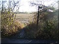
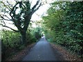
Footpath on Iwade Road
Leads to railway and then onto Cold Harbour Lane.
Image: © David Anstiss
Taken: 17 Dec 2008
0.17 miles
7
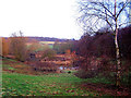
Pond in old orchard
This attractive pond is artificially created, and looks to be part of a landscape garden. It is home to a number of wildfowl. It lies just to the north of the footpath between Newington and Oak Hill
Image: © Richard Dorrell
Taken: 16 Dec 2007
0.20 miles

9
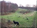
Footpath towards Oak Hill
This land is a partially cleared orchard, now not being farmed at all. The woodland on the left is mostly Chestnut.
Image: © Richard Dorrell
Taken: 16 Dec 2007
0.23 miles
10
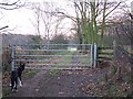
Gate and stile
Track and public footpath continue to Oak Hill
Image: © Richard Dorrell
Taken: 16 Dec 2007
0.24 miles