IMAGES TAKEN NEAR TO
Chaffes Lane, SITTINGBOURNE, ME9 7BG
Introduction
This page details the photographs taken nearby to Chaffes Lane, ME9 7BG by members of the Geograph project.
The Geograph project started in 2005 with the aim of publishing, organising and preserving representative images for every square kilometre of Great Britain, Ireland and the Isle of Man.

There are currently over 7.5m images from over14,400 individuals and you can help contribute to the project by visiting https://www.geograph.org.uk
Image Map
Images are licensed for reuse under creativecommons.org/licenses/by-sa/2.0
Notes
- Clicking on the map will re-center to the selected point.
- The higher the marker number, the further away the image location is from the centre of the postcode.
Image Listing (33 Images Found)
Images are licensed for reuse under creativecommons.org/licenses/by-sa/2.0
Image
Details
Distance
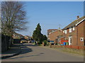

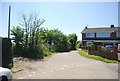

9
Footpath to Chaffe's Lane, Upchurch
This photograph is taken from the same spot as Image but looking in the opposite direction.
Image: © Richard Dorrell
Taken: 10 Feb 2008
0.07 miles
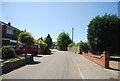
10
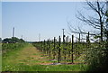
Footpath off Chaffe's Lane across orchards
Image: © N Chadwick
Taken: 23 May 2010
0.07 miles