
IMAGES TAKEN NEAR TO
Rawling Street, SITTINGBOURNE, ME9 0RU
Introduction
This page details the photographs taken nearby to Rawling Street, ME9 0RU by members of the Geograph project.
The Geograph project started in 2005 with the aim of publishing, organising and preserving representative images for every square kilometre of Great Britain, Ireland and the Isle of Man.

There are currently over 7.5m images from over14,400 individuals and you can help contribute to the project by visiting https://www.geograph.org.uk
Image Map
Images are licensed for reuse under creativecommons.org/licenses/by-sa/2.0
Notes
- Clicking on the map will re-center to the selected point.
- The higher the marker number, the further away the image location is from the centre of the postcode.
Image Listing (9 Images Found)
Images are licensed for reuse under creativecommons.org/licenses/by-sa/2.0
Image
Details
Distance
1
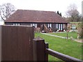
Moremuck Barn
On Rawling Street, converted barn was a part of Rawling Street Farm.
Image: © David Anstiss
Taken: 24 Mar 2009
0.01 miles
4
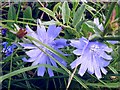
Chicory (Cichorium intybus)
Growing at the junction of Slough Road with an unnamed lane which comes up from Rawling Street. My camera doesn't 'see' this colour very well, I have tried to adjust the colour to reflect what was there but still feel the actual blue was more intense and really jumps out at you from the verge.
Image: © Penny Mayes
Taken: 13 Sep 2006
0.16 miles
5
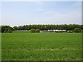
Lion Farm, Rawling Street
From across the valley.
Image: © Penny Mayes
Taken: 12 May 2006
0.19 miles
6
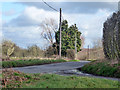
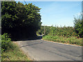
Slough Road
There is quite a tangle of lanes here, in the main not going anywhere important. This could be said to be a way to Erriottwood.
Image: © Robin Webster
Taken: 4 Apr 2015
0.19 miles
7
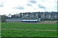
Lion Farm
So called on the map, although not much like a farm, the lean-to looks like offices. It seems to have been demolished later.
Image: © Robin Webster
Taken: 4 Apr 2015
0.22 miles
8
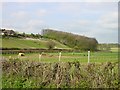
Looking north east across Bottom Pond Road
Bottom Pond Road runs along a valley from Bottom Pond to Highsted.
Image: © Penny Mayes
Taken: 19 Apr 2005
0.25 miles
9
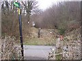
Footpath crosses Broadoak Road
Footpath No. ZR49 leads uphill from Bottom Pond Road, then crosses this road then goes into Birch Wood leading to Rawling Street, beside the Red Lion Public House.
Image: © David Anstiss
Taken: 24 Mar 2009
0.25 miles