IMAGES TAKEN NEAR TO
Kingsdown, SITTINGBOURNE, ME9 0QT
Introduction
This page details the photographs taken nearby to ME9 0QT by members of the Geograph project.
The Geograph project started in 2005 with the aim of publishing, organising and preserving representative images for every square kilometre of Great Britain, Ireland and the Isle of Man.

There are currently over 7.5m images from over14,400 individuals and you can help contribute to the project by visiting https://www.geograph.org.uk
Image Map
Images are licensed for reuse under creativecommons.org/licenses/by-sa/2.0
Notes
- Clicking on the map will re-center to the selected point.
- The higher the marker number, the further away the image location is from the centre of the postcode.
Image Listing (15 Images Found)
Images are licensed for reuse under creativecommons.org/licenses/by-sa/2.0
Image
Details
Distance
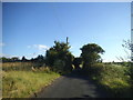
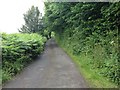
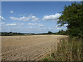
6
View from Pitstock Road
This is just north of the road junction at Dungate on the way to Rodmersham.
Image: © Marathon
Taken: 20 Aug 2019
0.10 miles
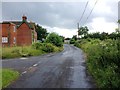
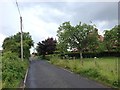
7
Pitstock Road
This is just north of the road junction at Dungate on the way to Rodmersham.
Image: © Marathon
Taken: 20 Aug 2019
0.10 miles
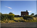
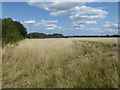
8
View from Pitstock Road
This is just north of the road junction at Dungate on the way to Rodmersham.
Image: © Marathon
Taken: 20 Aug 2019
0.11 miles
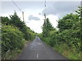
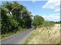
9
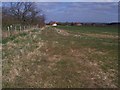
Footpath meets bridleway near Orchard
Footpath No.ZR226 from Sawpit Road, near M2 Motorway roadbridge meets bridleway heading to Slough Road, Dungate. Bridleway also heads right to Hole Street Farm on Kingsdown Road.
Image: © David Anstiss
Taken: 24 Mar 2009
0.12 miles