IMAGES TAKEN NEAR TO
Down Court Road, SITTINGBOURNE, ME9 0AT
Introduction
This page details the photographs taken nearby to Down Court Road, ME9 0AT by members of the Geograph project.
The Geograph project started in 2005 with the aim of publishing, organising and preserving representative images for every square kilometre of Great Britain, Ireland and the Isle of Man.

There are currently over 7.5m images from over14,400 individuals and you can help contribute to the project by visiting https://www.geograph.org.uk
Image Map
Images are licensed for reuse under creativecommons.org/licenses/by-sa/2.0
Notes
- Clicking on the map will re-center to the selected point.
- The higher the marker number, the further away the image location is from the centre of the postcode.
Image Listing (5 Images Found)
Images are licensed for reuse under creativecommons.org/licenses/by-sa/2.0
Image
Details
Distance
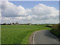
1

Down Court Farm, Doddington
Agricultural machinery in the farm yard.
Image: © pam fray
Taken: 19 Nov 2017
0.02 miles
2
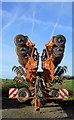
Down Court Farm, Doddington
A Simba Great Plains cultivator in the farm yard.
Image: © pam fray
Taken: 19 Nov 2017
0.02 miles
4
Very flinty soil
The geological map shows clay with flints over chalk.
Image: © Robin Webster
Taken: 9 Feb 2014
0.15 miles
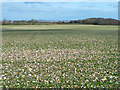
5
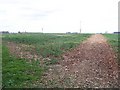
Footpath to Down Court
Path from Dully Hill leads through Rape field to Down Court Road.
Image: © David Anstiss
Taken: 24 Mar 2009
0.21 miles